Category archive

Transportation

Transit, trains, roads, traffic and getting around the region.

Turlock Sidewalk Repairs: What City Help Can Cover
in Transportation/Housing
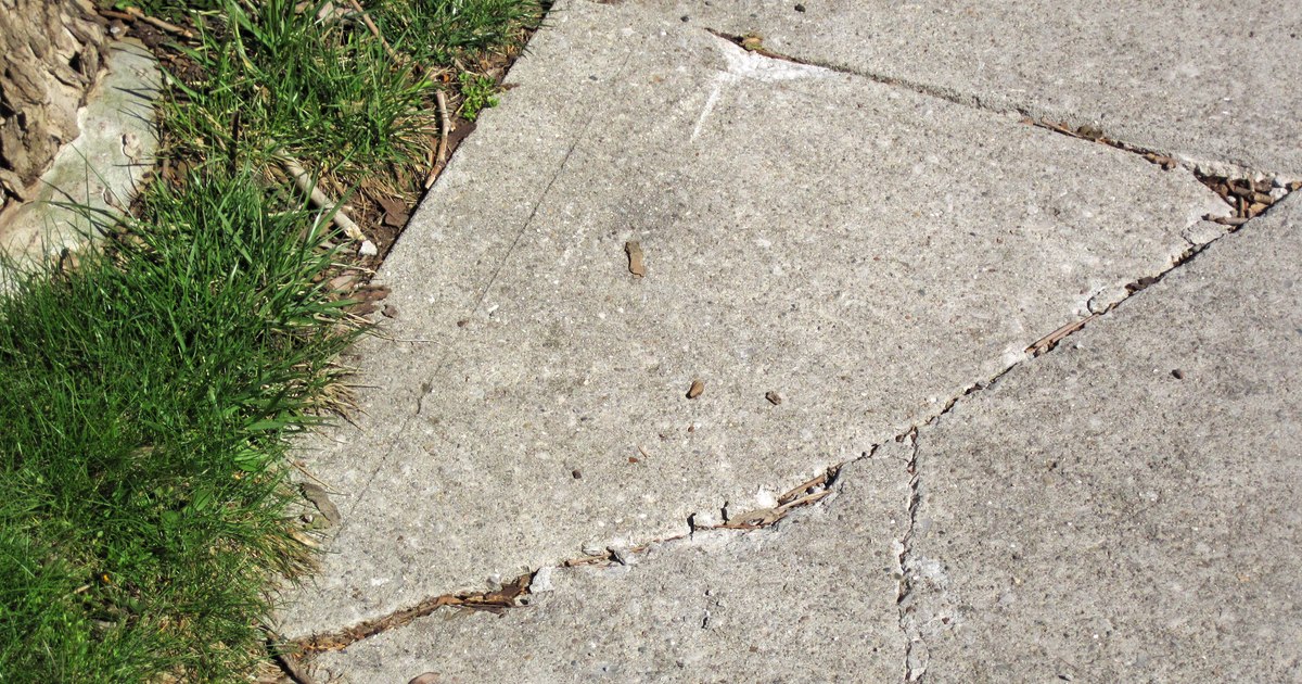
Tree roots have lifted and cracked a concrete sidewalk in Columbus, Ohio.
Illustrative sidewalk damage in Columbus, Ohio, April 2024. Photo: James St. John / Wikimedia Commons, CC BY 2.0. Cropped and resized.

A lifted sidewalk panel can turn a short walk into a detour. For the homeowner beside it, the next surprise may be the repair bill. Turlock has a program that can help pay for that work, but the dollar limits matter just as much as the percentages.

Here is how the assistance works, what to ask before agreeing to a repair, and where to flag a route that is difficult to use with a wheelchair, walker or stroller.

What the City Can Pay

Turlock’s Sidewalk Repair Assistance Program has two levels:

  • General assistance: 55% of eligible repair costs, up to $1,250.
  • Income-qualified assistance: 85%, up to $2,500, for applicants who meet the financial criteria.

The program operates while funds are available. The Turlock Journal’s report on the program explains that the general tier is available regardless of income. The higher tier requires qualification. The city adopted the program in December 2025.

A cap changes the calculation. Suppose the approved eligible work costs $4,000. At the general tier, 55% would be $2,200, but the $1,250 cap leaves the owner paying $2,750. At the enhanced tier, 85% would be $3,400, but the $2,500 cap leaves $1,500. Those are simplified examples, not contractor quotes or approval promises.
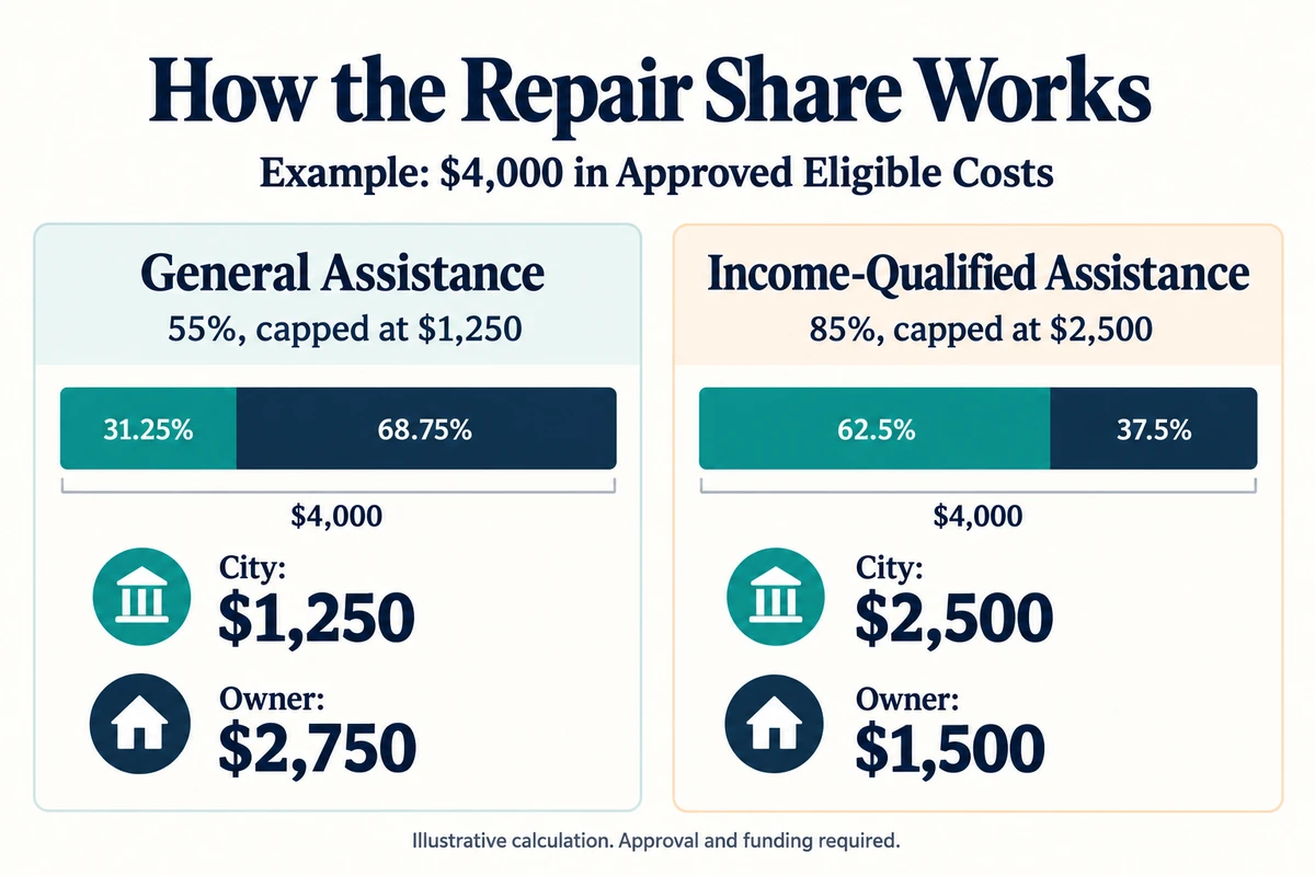
For a $4,000 approved eligible repair, general assistance leaves $2,750 to the owner; income-qualified assistance leaves $1,500.
A simplified $4,000 example shows how the dollar caps affect the final split. Illustration: Local Turlock.

Call Before Hiring Someone

Start with Engineering at 209-668-5520. The city’s sidewalk-repair guidance and application forms say the assistance program uses a city-hired contractor. Do not assume it will reimburse a contractor you have already hired.

  • Is funding available for this property, and what approval is needed before work starts?
  • Which costs count toward the award, and what will the owner owe?
  • What documentation is needed for the income-qualified tier?
  • Can this project receive the city’s separate help with encroachment-permit fees?

The city places frontage-sidewalk maintenance responsibility on the adjoining property owner. Repairs require an encroachment permit and inspections. If a notice gives you a deadline, contact Engineering before it passes to discuss the work or request an extension. If roots turn up during repairs, stop work and contact the city before cutting them or removing a street tree.

A Broken Panel and an Inaccessible Route Need Different Follow-Up

Engineering handles sidewalk-defect questions. Turlock also has an ADA accessibility project looking at curb ramps, crossings, pedestrian buttons and sidewalks as part of a broader improvement plan.

Its English-language mapping tool lets residents identify barriers and suggest improvements. The city also links a Spanish version from its accessibility page. Zoom to the location, choose the appropriate issue or improvement marker, then describe the obstacle and how it affects the trip.
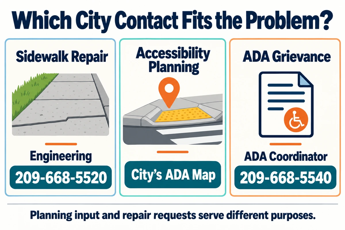
Sidewalk repair: Engineering, 209-668-5520. Accessibility planning: the city's ADA map. ADA grievance: ADA coordinator, 209-668-5540.
Choose the repair contact, planning map or ADA grievance process according to the issue. Illustration: Local Turlock.

The map collects planning input. A pin is not a repair appointment or a promised completion date. For an accessibility complaint or formal ADA grievance, the city lists ADA coordinator Paul Loehr at 209-668-5540 and ploehr@turlock.ca.us.

Where Would a Sidewalk Repair Make the Biggest Difference?

Tell us which Turlock street or intersection needs a better walking route. Add your experience to the discussion on our Facebook post.

If the obstacle is on the way to a bus stop, include that connection in your description. Our Turlock Transit guide explains local bus travel. For other city departments, permits and service requests, use Help & Local Services.

The S Plans 2027 Bus Cuts: What Turlock Riders Should Watch

in Transportation
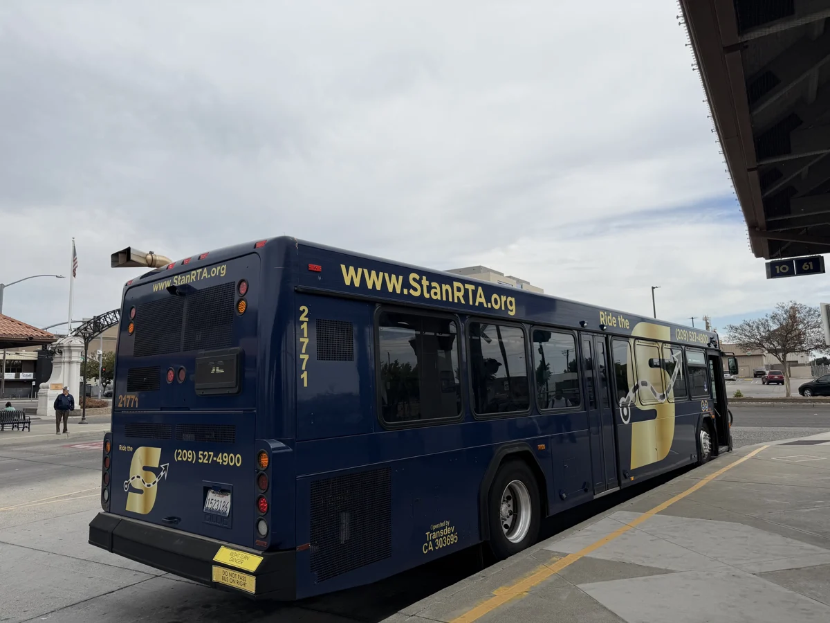
A blue-and-gold StanRTA bus at Modesto Transit Center on September 20, 2026.
A StanRTA bus at Modesto Transit Center, September 20, 2026. Photo: Evan0512 / Wikimedia Commons, CC BY-SA 4.0. Resized.

A bus trip from Turlock can work perfectly until the connection in Modesto changes. That is why a regional service-cut proposal deserves attention here, even if you usually think of The S as the buses in the next town.

Stanislaus Regional Transit Authority, which operates The S, is developing changes for 2027. Reporting by the Central Valley Journalism Collaborative, published in the Turlock Journal, describes a proposed 15% service reduction intended to address a $3 million shortfall. The report says a proposal is expected before the board on December 3, with changes targeted before July 1, 2027.

This is a planning story, not a notice that Turlock’s city buses have just been cut. The regional agency and Turlock Transit are separate operators, with separate plans underway. For today’s ride, keep using the current published schedules and service alerts.

What Is Being Proposed?

The regional project is called Connect the S. Its official site links to interactive maps comparing existing and proposed service, along with planning reports and outreach findings. Longer-term work also examines bus rapid transit, including ways to make busy corridors faster and more dependable.

There is a trade-off behind the maps. Concentrating buses where more people ride can make those corridors more useful, while leaving other passengers with a longer walk or a different transfer. A route line getting shorter on paper can mean a substantial change for someone carrying groceries, traveling with a child or reaching a medical appointment.

The financial pressure predates this week’s coverage. In its 2026-27 budget materials, StanRTA discussed seeking $4.2 million in Measure L rail-connection funding to sustain existing services while the short-range plan was developed. Those materials identified Routes 25, 70 and 90/100 as rail-related connections. They also warned of a potential 15% operating-service reduction without that funding. A funding request and an adopted route timetable are different steps; neither tells a passenger, by itself, which departure will operate next summer.

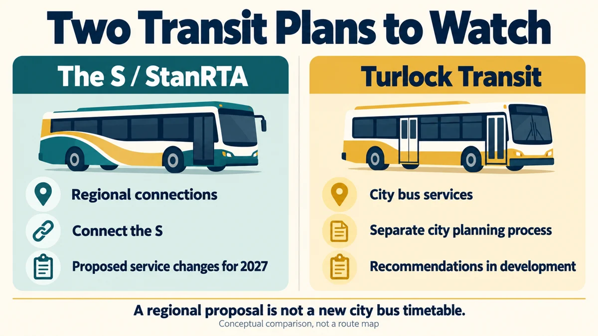
Conceptual comparison: StanRTA's regional Connect the S proposal and Turlock Transit's separate city planning process.
A regional proposal is not a replacement timetable for Turlock’s city routes. Conceptual comparison; the buses are illustrations.

The Turlock Connections Worth Checking

The S already connects Turlock with destinations outside the city. These are useful starting points for reviewing your own trip, not a list of routes confirmed for elimination:

  • Route 10: the Modesto/Turlock connection. The current timetable lists trips between the two transit centers.
  • Route 29T: the connection through Ceres and Keyes to Turlock.
  • Route 45: service linking Newman, Patterson and Turlock.
  • Route 100: the weekday Turlock/Patterson BART connection, with a transfer to the Modesto BART coach near Corral Hollow Road in Tracy Hills.

Check the second bus as carefully as the first. A Turlock-to-Modesto departure can remain available while an onward journey becomes less convenient. Compare the destination stop, walking distance, transfer time and final trip home, rather than looking only for your familiar route number.

Turlock Transit Has Its Own Plan

The city’s Short-Range and Long-Range Transit Planning page describes a separate review of local fixed routes, paratransit, on-demand service and regional connections. Its published timeline puts recommendations in fall 2026 and completion of the short-range plan in winter 2026 or early 2027.

Evening service, Sunday service, technology and stop improvements appear among the subjects being evaluated. Those are possibilities under review, not promises that a Sunday bus or a particular new route has been funded. The city says future outreach will share draft recommendations.

For the basics of riding around town now, our Turlock Transit guide explains routes, fares and a first bus ride. The Roger K. Fall Transit Center guide covers the wider connections, including the separate Amtrak station in Denair.

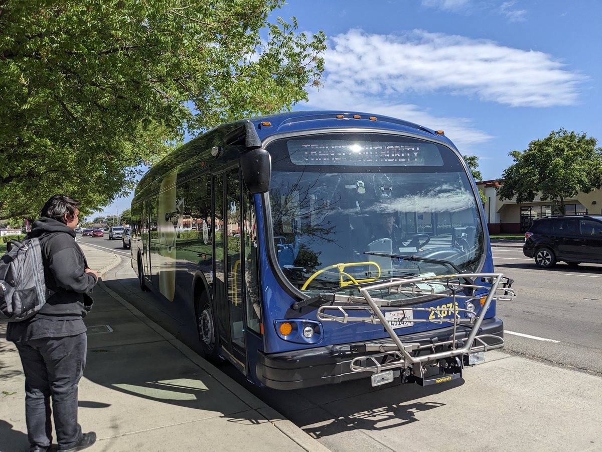
A blue StanRTA bus stopped near Monte Vista Crossings in Turlock in April 2024.
A StanRTA bus near Monte Vista Crossings, April 2024. Photo: Evan0512 / Wikimedia Commons, CC BY-SA 4.0. Resized. The photograph does not establish a current timetable.

How to Follow the Decision

December 3 is the date to watch in the regional reporting, but check the StanRTA Agenda Center before making plans to attend. The October 22 agenda lists the next regular meeting for December 3 at 1 p.m. and includes a proposal to revise that meeting’s location. It does not list approval of the route-cut plan for October 22.

Before sending feedback, open the comparison maps and write down one trip you actually need to make: where you board, your destination, the day and arrival time, and the connection home. If a proposed stop adds a difficult walk or misses a shift change, explain that specific problem. You can describe the trip without posting private medical or workplace details publicly.

Start with the official project maps and news-alert links. Keep the current routes and schedules bookmarked for travel today, and look for the December agenda when it is posted. That is where to check the actual proposal, meeting location and participation instructions.

Which Bus Connection Do You Rely on Most?

Share your experience in the Facebook discussion for this story.

Roger K. Fall Transit Center: Turlock Buses, Amtrak & Beyond

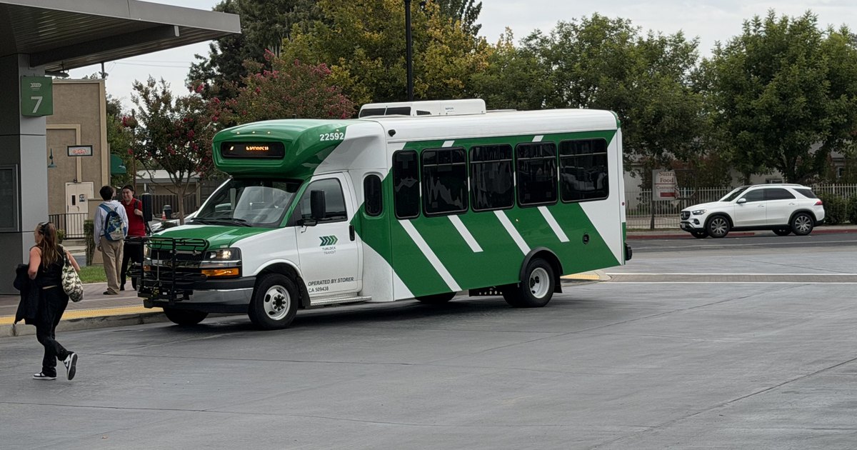
Turlock Transit bus at bay 7 of the Roger K. Fall Transit Center.
A Turlock Transit bus at bay 7 in August 2026. Photo: Evan0512 / Wikimedia Commons, CC BY-SA 4.0; cropped.

You can get from Turlock to Sacramento, the Bay Area or Yosemite without driving the whole way. The trick is knowing which bus to take, where the train actually stops and how to get home. Roger K. Fall Transit Center is the starting point for many of those trips—and a useful place to ask someone to help you plan one. Start with the Right Place The Roger K. Fall Transit Center is at 1418 N.… Keep Reading

Highway 152: Los Banos, Pacheco Pass & the Road to the Coast

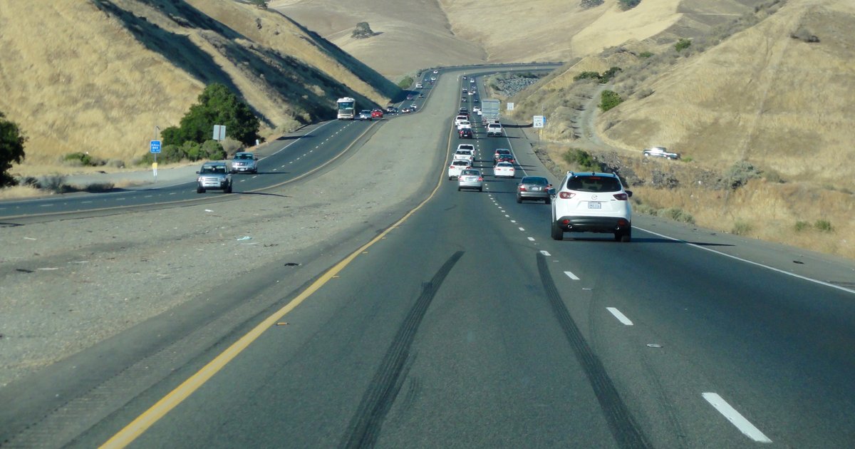
Highway 152 curving through the dry hills at Pacheco Pass in July 2015
Highway 152 at Pacheco Pass, July 2015. Photo: Chevy111 / Wikimedia Commons, CC BY-SA 4.0; resized and cropped. This crop is also CC BY-SA 4.0.

The reservoir beside Highway 152 looks as though it has always been there. It hasn’t. Before San Luis Reservoir filled, this was ranch country; before cars crossed Pacheco Pass, travelers paid a toll and stagecoaches worked their way through the hills. From Turlock to Los Banos Olive Avenue connects with Lander Avenue at downtown Turlock. Follow Lander south and, beyond Highway 99, the state-highway portion is Highway 165, serving Hilmar, Stevinson and Los Banos. The… Keep Reading

Highway 99 in Turlock: The Old Road, the Overpass and the Freeway

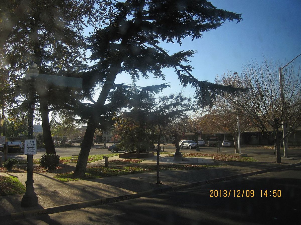
Trees and paths at Central Park in downtown Turlock.
Central Park in downtown Turlock, December 2013. Photo: peter boy12qq12 / Wikimedia Commons · CC BY 3.0.

Before Highway 99 meant on-ramps and a fast trip to Modesto, it meant driving through Turlock. Golden State Boulevard carried the highway, and a dangerous railroad crossing stood between motorists and town. The freeway took decades to arrive. Its route helped decide where the next Turlock would grow. The Old Highway Is Still Part of Town The familiar name Golden State Boulevard is a piece of road history. It was the through-town route of U.S.… Keep Reading

Turlock Transit Guide: Routes, Fares and Your First Bus Ride

in Transportation
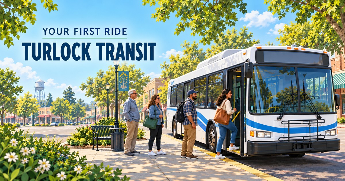
Editorial illustration of a city bus and passengers at a sunny bus stop for a Turlock Transit first-ride guide
Editorial illustration.

You have driven past the bus stops for years. Then your car is in the shop, someone needs a ride across town, or you start wondering whether every small errand really needs a car. Suddenly the questions get very practical: Which bus do I take? How do I pay? And how do I make sure I can get home?

This Turlock Transit guide walks through that first ride, from finding a stop to getting off at your destination. You do not need to memorize the whole system. Start with one trip, one route and a return plan.

The Essentials Before You Leave Home

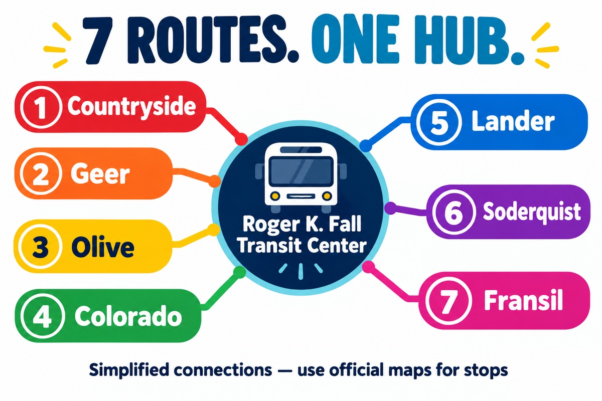
  • Seven local routes: numbered 1 through 7, with maps and individual schedules.
  • A regular $2 all-day pass: it covers unlimited fixed-route rides that day, including changes between local buses.
  • The main hub: Roger K. Fall Transit Center, 1418 N. Golden State Boulevard. All seven routes serve it.
  • Service days: Monday through Saturday. There is no regular Sunday service.

Keep the official system map and downloadable rider guide handy. The guide is available in English and Spanish. Maps explain where a bus travels; the timetable tells you when it gets there.

Where Do Turlock Transit’s Seven Routes Go?

The following is an orientation to the network, rather than a list of every stop. A destination shown along a route can still involve a walk from the stop to its entrance. Open the linked route map and check the exact stop before heading out.

  • Route 1 — Countryside: a north-side loop connecting the Transit Center with the Countryside/Monte Vista shopping area, Monte Vista and Dels near Stanislaus State, and Geer and Minnesota. It is a starting point for planning trips toward Monte Vista Crossings and the university.
  • Route 2 — Geer: connects Geer and Tuolumne, Monte Vista and Dels, and Countryside at Monte Vista Crossings. Routes 1 and 2 circulate in opposite directions around the north-side area, so compare them for both legs of a shopping or campus trip.
  • Route 3 — Olive: reaches the Christoffersen corridor near Pitman High School and Turlock Junior High, the north side of the university area, and Delbon at Emanuel Medical Center. Check the walk from the stop if you have a medical appointment.
  • Route 4 — Colorado: serves east-side corridors including Colorado and Lyons, Alpha and Cottonwood, and Minaret and Cahill. The map includes the Turlock High School, Dutcher Middle School and Turlock Library areas.
  • Route 5 — Lander: connects the hub with Central Park and downtown, continues toward Lander and Linwood, and returns through the Golden State and Minerva area. It is useful to investigate for downtown errands and south-side destinations.
  • Route 6 — Soderquist: covers west and southwest neighborhoods, with scheduled points at Tully and Main, West and South, and Soderquist and Canal.
  • Route 7 — Fransil: serves west-side destinations through West Main and Kilroy, Fransil at Amazon, and Fulkerth and Dianne. Its map helps with trips toward the movie theater and the Fransil employment area.

Follow the arrows on the map. These routes run as loops. Your ride home may continue around the loop or use a different route. Crossing the street and waiting for the same number to travel back the other way is not a reliable return plan.

Colorful conceptual diagram connecting Turlock Transit routes 1 Countryside, 2 Geer, 3 Olive, 4 Colorado, 5 Lander, 6 Soderquist and 7 Fransil to Roger K. Fall Transit Center.
Conceptual route diagram. Colors are illustrative; lines show shared access to the Transit Center, not geographic paths.

How to Plan a Trip Without Getting Overwhelmed

  1. Choose an exact destination. Use the address or entrance you need, rather than just “downtown” or “the university.”
  2. Find the closest useful stops at both ends. Compare the route path, its direction and the walking distance. The closest stop to your home is only helpful if it connects with where you want to go.
  3. Read across one timetable row. A row represents a scheduled trip. Match the departure at your boarding point with the later arrival near your destination. The tables list selected timing points, so an intermediate stop may need the live lookup.
  4. Plan the return before leaving. Save the stop location, route number and last usable departure. Include time for a connection if your trip needs two buses.

The official live bus information page lets you select a route and stop to see arrival predictions. Treat a prediction as an estimate; traffic and loading can affect it. For a first trip, our suggestion is to arrive five to ten minutes early and allow an extra cushion before an appointment.

Hours, Frequency and the Last Bus

Turlock Transit lists service hours of 6 a.m. to 9 p.m. Monday through Friday and 9 a.m. to 7 p.m. Saturday. Those are overall operating hours, not a promise that a bus departs your particular stop at closing time.

The route schedules show the first weekday departures from the Transit Center at 6 a.m. and the last at 8:30 p.m. Saturday departures begin at 9:10 a.m. and end at 6:25 p.m. Gaps between scheduled hub departures vary, commonly around 35 to 40 minutes during much of the day. Check the actual row instead of assuming a bus comes every half hour. See the published departure schedule and your own route’s page.

Holiday service can differ. The official FAQ lists closures including New Year’s Day, Presidents Day, Memorial Day, Independence Day, Labor Day, Thanksgiving and Christmas. Check the agency’s current notices around holidays.

What Does It Cost, and How Do You Pay?

The current fixed-route fare page lists:

  • Regular: $2 for an all-day pass or $30 for a 31-day pass.
  • Discount: $1 for an all-day pass or $15 for 31 days for riders 55 and older, people with disabilities and Medicare cardholders.
  • Free eligible groups: youth 18 and younger; college students and faculty; public education students, faculty and staff; active military and honorably discharged veterans. Bring the identification or eligibility proof applicable to your group.

A 31-day pass begins with its first use. Local transfer slips are unnecessary because the period pass allows unlimited local rides during its validity.

You can buy a day pass aboard the bus. The Transit Center sells passes and stored-value cards; its ticket window is cash only, according to the rider guide. Bringing the correct cash amount keeps a first ride simple. Electronic fareboxes can issue a Change Card for future use rather than cash back, according to the agency’s farebox information.

For phone payment, Token Transit sells mobile passes. Set up the app before your trip, activate the pass just before boarding, and follow the farebox validator instructions. Buying and activating require a data connection; an activated pass can be used without one. Keep your phone charged.

Your First Ride, Step by Step

  1. Wait at the marked stop. Stay visible and safely back from the curb. Check the route number when the bus approaches.
  2. Let exiting passengers finish, then board. Before paying, ask the driver whether this bus serves your intended stop. A short explanation that this is your first ride helps make the question clear.
  3. Pay or present your pass. Have cash, your active mobile pass or eligibility identification ready. Keep your day pass for subsequent rides.
  4. Find out how to request your stop. Ask the driver to point out the stop-request control and which door to use when leaving. That is easier to do at boarding than when your destination is already passing the window.
  5. Sit or hold a handrail. Keep your belongings out of the aisle and watch your progress against the route map.
  6. Request the stop before you reach it. Give the driver time to stop safely. Wait until the bus has stopped before stepping off, then use a safe crossing to reach your destination.

If you miss your stop, tell the driver and ask about the next safe place to get off. For your first outing, choose an errand with a flexible arrival time. You can learn the routine without also racing a clock.

A Simple Downtown Practice Trip

Here is a scheduled example to make the timetable less abstract: Route 5 leaves the Transit Center at 9:10 a.m. and lists Central Park at 9:14 a.m. A later bus is listed at Central Park at 9:49 a.m., then back at the Transit Center at 10:06 a.m. after continuing around the loop.

Those times illustrate how to read a trip, rather than guarantee a particular day’s arrival. Check live information and stop notices before using the example. Notice the return takes longer than the short outward leg: that is why the route’s direction matters.

Changing Buses and Traveling Beyond Turlock

If one route does not connect both ends of your trip, the Transit Center is the common hub for switching between the seven routes. Use your valid local day or 31-day pass on the next Turlock Transit bus. Leave a buffer between the scheduled arrival and departure; a connection is not guaranteed simply because both times appear close together.

Trips toward other communities involve a separate regional system. Turlock Transit’s connection information points riders to Stanislaus Regional Transit Authority, The S, and Merced County’s The Bus. The current rider guide says to request a free transfer to The S when boarding your first bus. Check the connecting operator’s route, fare and last return trip separately, and confirm the transfer with your driver.

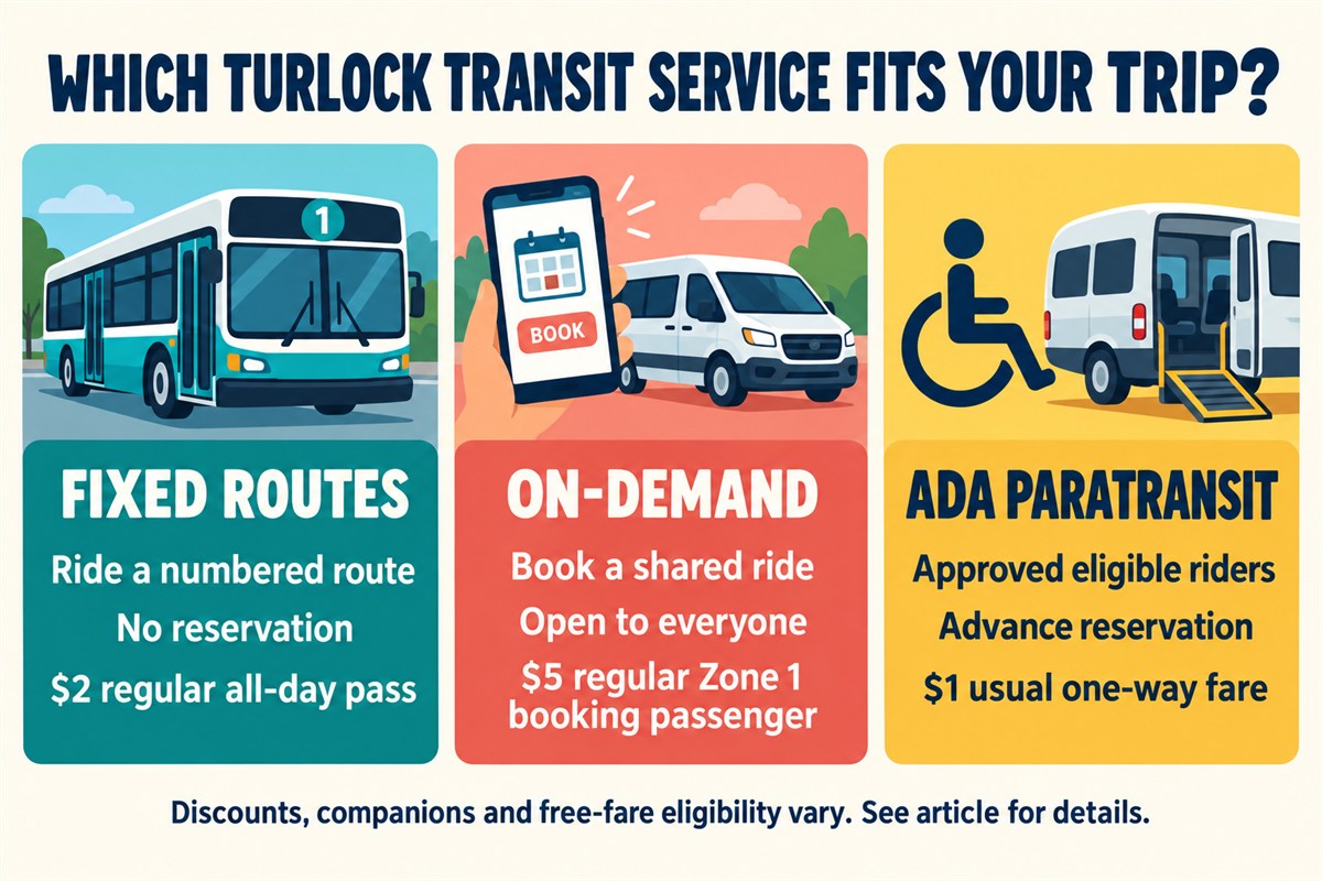
Three colorful cards compare Turlock Transit fixed routes, on-demand rides and ADA paratransit, with regular fares and reservation requirements.
Turlock Transit service options. Regular fares shown; eligibility and discounts vary.

Accessibility, on-Demand and Getting Extra Help

Turlock Transit’s buses accommodate wheelchairs through ramps or lifts. Ask about boarding assistance and securement when needed. The agency’s accessibility information also links to reasonable-modification resources and free travel training.

On-Demand is a different service from the numbered routes: a reserved, shared, curb-to-curb ride open to the public in Turlock and Denair, including the Amtrak station. Book through the Turlock Transit app or call (209) 668-5600. Availability and separate fares apply. The usual in-town Zone 1 fare is $5 for the booking passenger, with $3 companions; qualifying discount riders and trips involving Zone 2 pay $2.50 per passenger. Denair trips have shorter hours: 7 a.m. to 8 p.m. weekdays and 10 a.m. to 6 p.m. Saturday. Read the service and zone information before booking.

ADA paratransit serves qualified riders whose disabilities prevent them from using the fixed-route system. Eligibility is based on functional ability. Reserve by 5 p.m. on the preceding business day; the usual eligible adult fare is $1 one way. The current paratransit page directs applicants to ADARide at (209) 284-4577. A disability discount on a regular bus and paratransit eligibility are separate matters.

There are also different apps with similar names. Transit provides fixed-route trip planning, live information and mobile tickets; Token Transit handles mobile fares; the agency’s Turlock Transit app is used to book and manage reserved trips. You do not need to reserve a seat on an ordinary numbered fixed-route bus.

A Few Habits That Make Riding Easier

Bringing a bicycle can extend the distance you can travel from a stop. The agency says its buses have bike racks. For your first trip with a bike, ask about loading, rack space and whether your bicycle fits before traveling.

The agency’s rider rules prohibit eating and drinking aboard; keep food and beverages sealed. Use headphones, keep the aisle clear, and remember that children under nine must ride with an adult. Pets that fit in a carrier on your lap are permitted, with service animals treated separately.

Leave priority seating available for seniors and people with disabilities, and ask the driver questions while the bus is parked.

Before each outing, check the official website and live map for service changes. Construction can move a stop even when the route itself is still running. Save (209) 668-5600 for Turlock Transit questions. For arrival information without the map, the rider guide lists calling or texting your stop ID to (209) 222-2154.

Try one manageable trip this week. Pick a familiar destination, plan both directions and give yourself time. If you would like someone to help you learn the system, ask about MOVE’s free travel training at (209) 672-1143. Knowing how to use the bus gives you one more way to get around Turlock when you need it.

For more local updates, browse Local Turlock’s transportation coverage.

Service information checked October 11, 2026, against Turlock Transit’s official route pages, fare information and currently linked rider guide. Schedules, fares and individual stops can change; confirm your trip with the agency before traveling.

Box Truck Strikes and Badly Injures Man Standing by Car on Highway 99 in Keyes, CHP Reports

in Transportation/Public Safety

A commercial truck struck a man standing next to a car on Highway 99 in Keyes early Monday, the California Highway Patrol reported.

Ezequiel Gonzalez Mejia, 41, of Los Angeles suffered major injuries and was taken to Doctors Medical Center in Modesto, a news release said. The nature of his injuries was not reported.

Continue reading on NewsBreak

New Details in Death of Woman Who Was Assaulted and Left on Modesto Highway Off-Ramp

in Transportation/Public Safety

The investigation continues for police into a brutal domestic violence and homicide case in Modesto.

This incident happened Friday night when Modesto Police said they responded to the area of 6th Street at the Highway 99 northbound off-ramp to help CHP with a possible hit-and-run crash between a vehicle and a pedestrian.

The vehicle fled the scene, and police said the woman was found on the ramp. She was sent to the hospital, where she later died from her injuries.

Continue reading on KCRA.com

Highway 99 Sees Closures from Flooding, Heavy Traffic and Jackknifed Semi-Truck, CHP Says

in Transportation/Public Safety

Because of flooding and a jackknifed semi-truck on the southbound side of Highway 99 in Modesto on Monday morning, the California Highway Patrol urged drivers to find other routes.

The pair of incidents caused major delays for commuters, according to the CHP’s Modesto office. By 8:30 a.m. it appeared that both were being addressed. However, the traffic backup was expected to last well after that.

Continue reading on NewsBreak

Stanislaus Has Redone Some Streets to Aid Pedestrians and Cyclists. Here Is a Sampling

in Transportation/Public Safety

Streets are not just for motor vehicles, advocates for walkers and bicyclists have argued in Stanislaus County and beyond.

The county has several recent and current projects aimed at slowing cars and trucks near schools and other busy spots.

Pedestrians at some crosswalks now can press a button that triggers flashing warning lights for drivers. Some corners have “bulb-outs,” where the sidewalk extends into the parking lane to make people on foot more visible.

Continue reading on Modesto Bee

1 2 3 … 7
Go to Top