Category archive

Environment

Water, energy, conservation, wildlife and environmental issues.

Turlock Leaf Pickup Starts Monday: Find Your Zone and Get Ready
in Community/Environment
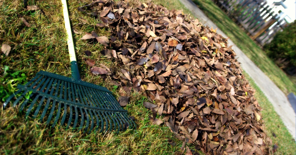
A green leaf rake beside a pile of fallen brown leaves. Illustrative file photograph.
Leaf-raking file photo: David Goehring / Wikimedia Commons, CC BY 2.0. Cropped and resized.

The leaves are coming down, and Turlock’s seasonal pickup starts Monday, November 2. Before dragging a pile toward the street, check two things: whether your green cart has room and which collection zone includes your house.

The city lists the 2026-2027 season as November 2 through February 5. That does not mean every street gets a visit on opening day. The zone map assigns different dates around town, and the weekly garbage route follows its own schedule.

How to Put Leaves Out for Pickup

The city’s leaf-pickup instructions say to use the green waste cart first. For leaves that will not fit:

  • Leave them loose. Do not bag the street pile.
  • Keep it leaves only. Wood and branches mixed into the pile mean it will not be collected.
  • Leave an 18-inch gap from the curb. Keep the gutter clear so water can drain.
  • Leave access for the crew. Avoid blocking the pile with parked vehicles the day before, the day of and the day after collection. Keep garbage carts separate from the leaves.
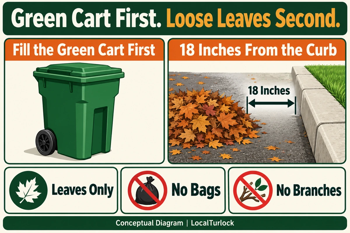
Use the green cart first. Overflow street piles must contain loose leaves only, without bags or branches, 18 inches from the curb. Conceptual diagram.
Use the green cart first; keep an 18-inch gap between the curb and loose leaves. Conceptual diagram, not to scale.

Find Your Zone Before Planning a Yard-Cleanup Day

Open the official 2026-2027 leaf-pickup map and route dates. Find your street, identify its numbered zone, then read the matching dates beside the map. Zoom in far enough to see the boundary near your address; a nearby major road can separate zones.

Save all of your zone’s dates, not just its first visit. A screenshot of the dated route list is handy when planning another round of raking later in the season. If your house appears close to a boundary, ask the city to confirm the zone before relying on a neighbor’s schedule.

Your Weekly Garbage Pickup Is a Different Schedule

The seasonal street-pile service and regular cart collection are separate. Turlock Scavenger’s residential service includes garbage, recycling and green waste. A leaf-zone date does not replace the normal day for those carts.

For regular collection, the city’s cart-placement rules say to have carts out by 5 a.m., with at least two feet between them and six feet from parked vehicles. Do not overfill a cart. Those are cart instructions; the leaf-pickup map supplies the dates for the loose street pile.

If a gardener helps with your yard, share the leaf date and placement instructions before the work starts. Make clear which material belongs in the cart and which loose pile is meant for city pickup. That saves having to untangle leaves from a heap of pruned branches afterward.
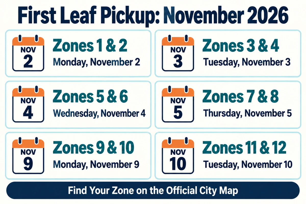
First pickups: zones 1-2 November 2; 3-4 November 3; 5-6 November 4; 7-8 November 5; 9-10 November 9; 11-12 November 10. All dates are in 2026.
The opening pickup dates in the city’s 2026-2027 route list. Later visits appear on the official map.

The First Pickup Dates by Zone

  • Zones 1 and 2: Monday, November 2.
  • Zones 3 and 4: Tuesday, November 3.
  • Zones 5 and 6: Wednesday, November 4.
  • Zones 7 and 8: Thursday, November 5.
  • Zones 9 and 10: Monday, November 9.
  • Zones 11 and 12: Tuesday, November 10.

These are the opening visits in the city’s published route list, not every pickup for the season. Follow the zone’s dated entries rather than assuming a recurring weekday.

Who to Call With a Pickup Question

For the city leaf program or an uncertain zone, call 209-668-5594. For a regular garbage or green-cart service issue, Turlock Scavenger lists 209-668-7274. Have the service address, usual collection day and the type of material ready so the right crew or office can help.

How Do You Handle the Fall Leaf Pile?

Do you rake as leaves fall or wait until the tree is nearly bare? Compare notes with neighbors on our Facebook post.

For other household-service questions, our Help & Local Services directory connects utilities, problem reporting and disposal resources. A lifted sidewalk is a separate issue from fallen leaves; our sidewalk-repair guide explains the city’s assistance program.
A Free Wildlife Drive From Turlock: Tule Elk and Fall Wetlands

in Places & Recreation/Environment
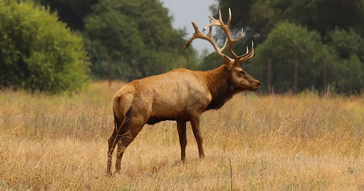
A tule elk with antlers stands in grass at San Luis National Wildlife Refuge.
Tule elk at San Luis National Wildlife Refuge, August 2022. John Heil/USFWS. Public domain.

There are tule elk south of Turlock, and you can look for them from your car. San Luis National Wildlife Refuge near Los Banos has a five-mile elk drive, a longer waterfowl loop and short marsh walks. Admission is free.

Autumn through spring is the refuge’s busy season for migrating waterbirds. For a first visit, start at the main entrance on Wolfsen Road. Both year-round driving loops begin there, so you can choose an outing without navigating between separate refuge units.

Featured photo: tule elk at San Luis, August 2022. John Heil/USFWS, public domain.

Getting There From Turlock

Head south on Lander Avenue, Highway 165, through Hilmar and Stevinson. Continue straight through the Highway 140 intersection toward Los Banos. The refuge’s directions put the Wolfsen Road turn 12.5 miles beyond that intersection; turn left and continue two miles to the entrance.

The destination is 7376 S. Wolfsen Road, Los Banos. FWS warns that some navigation systems stop a mile short. Keep going to the refuge entrance at the end of Wolfsen Road.

The outdoor routes and trails open daily, from half an hour before sunrise until half an hour after sunset. The visitor center has separate opening hours. Call 209-826-3508 if the indoor exhibits are part of your plan.

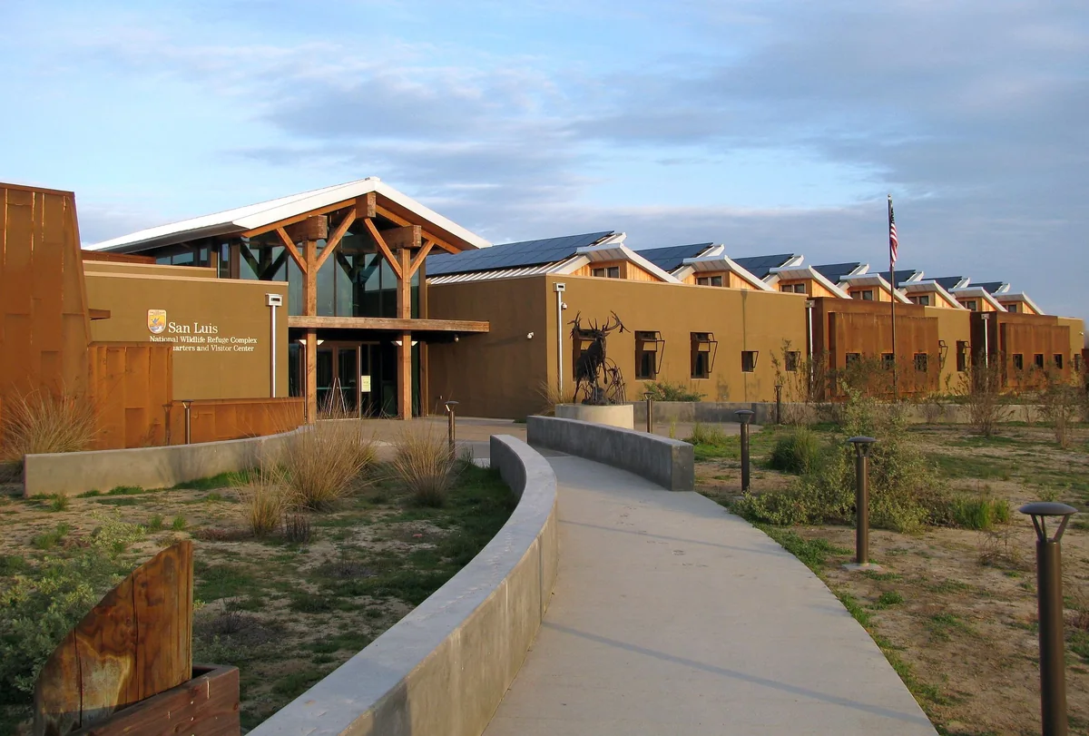
The San Luis National Wildlife Refuge visitor center, with solar panels and an elk sculpture outside the entrance.
The visitor center is just inside the main entrance. Photo: USFWS, public domain.

The Elk Have a Recovery Story

The animals here are tule elk, a subspecies found only in California. Their presence at the refuge is part of a long recovery effort. Hunting and habitat loss nearly wiped them out by the turn of the 20th century.

In 1974, a herd of 18 was established at San Luis. FWS says animals from this herd have since been moved to strengthen other herds or start new ones around California. The refuge itself was established in 1967, with its first parcel bought using federal Duck Stamp funds. Its history and wildlife overview explain how the elk and waterbird programs developed.

The five-mile Tule Elk auto tour circles a nearly 800-acre enclosure. A viewing platform with a spotting scope gives visitors a higher vantage point. This is a resident herd, but you still have to look for it across a large area. Bring binoculars rather than expecting the animals to gather beside the road.

Choose the Waterfowl Loop for a Longer Drive

The Waterfowl auto tour is 8.5 miles through wetlands and uplands. Wintering ducks use these marshes from fall into spring. Geese and sandhill cranes are among the winter visitors; tundra swans may also be seen. Those are seasonal possibilities, not a report of what is present on a particular morning.

Both main loops use compacted gravel roads. Follow the one-way signs and stay in your vehicle except at designated places where getting out is allowed. The official auto-tour guide explains the routes and viewing stops.

A passenger with binoculars has a different job from the driver. Let the driver watch the road while someone else scans the water and grass. When you reach a permitted viewing stop, give it a few minutes. A patch of reeds that looked empty from the moving car can turn out to be the most interesting stop.

Add a Walk at the Marsh

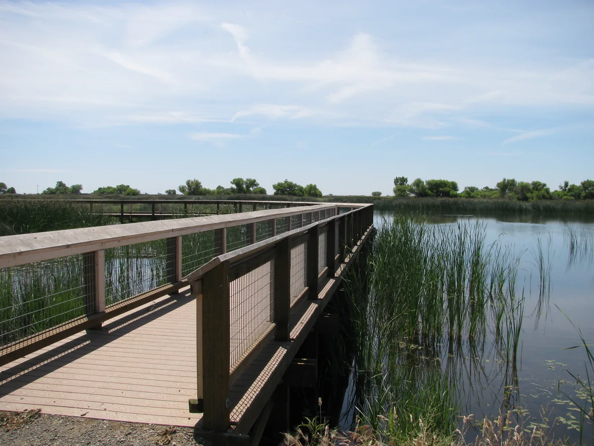
For a short walk, the Wetland Trail starts at the visitor-center grounds and runs 0.8 miles. Its gravel path and boardwalk follow a marsh, with benches along the way. The separate Upland Trail is half a mile and also begins at the visitor center.

A wooden boardwalk crosses a marsh on the Wetland Trail at San Luis National Wildlife Refuge.
The Wetland Trail boardwalk, photographed in May 2012. Photo: USFWS, public domain.

The trail descriptions list surfaces, distances and seasonal access. These walking paths are the places to stretch your legs. Walking, cycling and horseback riding are not allowed on the auto-tour roads.

What to Bring and Where to Stop

  • Binoculars, water and walking shoes. Add mosquito repellent for a fall visit.
  • A downloaded route map. The official brochure shows the refuge units, trails and facilities.
  • A plan to stay on public routes. Use designated parking, obey closed-area signs and leave wildlife alone. Dogs must be leashed outside vehicles; do not feed the animals.

Read the refuge’s visitor rules and download the map before leaving.

For a shorter walk closer to Turlock, see our guide to the pond at Ceres River Bluff Regional Park. Our nearby towns and day trips guide has more places to explore.

Have You Seen the Elk at San Luis?

Share a wildlife sighting or a favorite stop along the refuge routes.

The Pond Below Ceres’ Soccer Fields Is Worth a Walk

in Places & Recreation/Environment
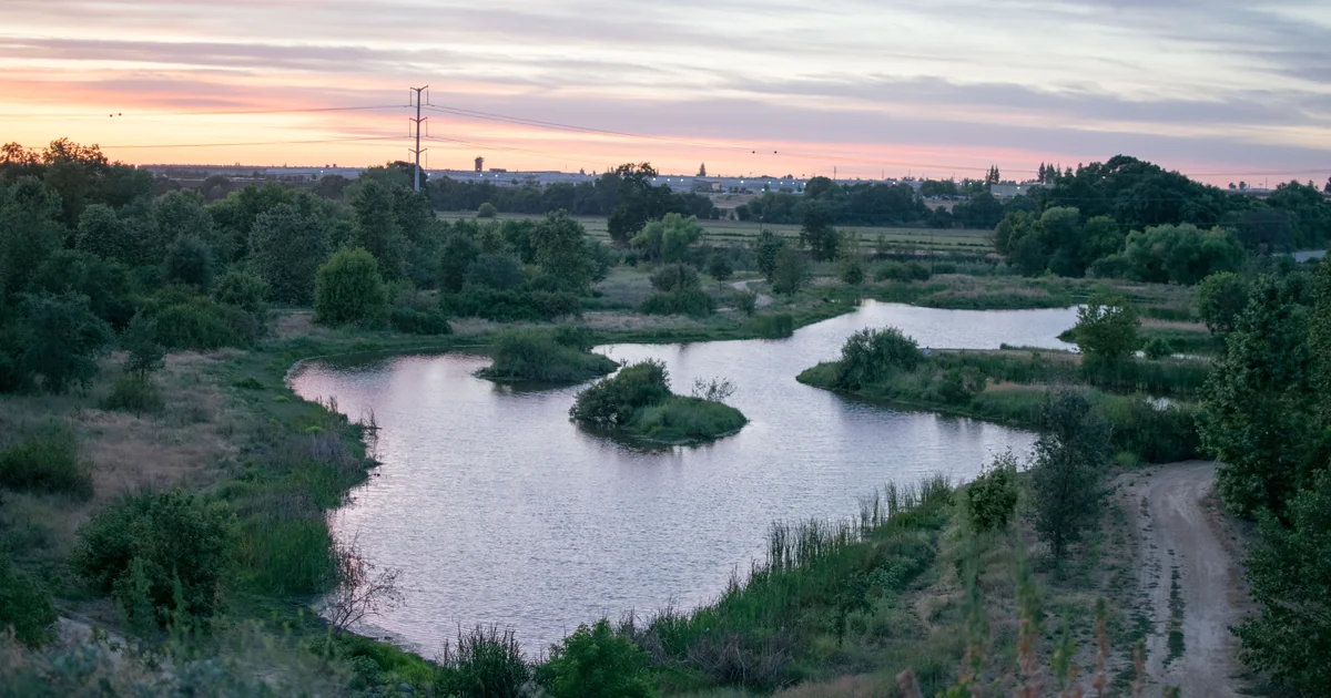
The winding pond below the bluff at Ceres River Bluff Regional Park at sunset.
The lower-terrace pond at Ceres River Bluff Regional Park, June 2016. Photo: Ryanx7 / Wikimedia Commons, CC BY-SA 4.0. Cropped and resized; this version is also CC BY-SA 4.0.

The soccer fields are only half the reason to visit Ceres River Bluff Regional Park. Below them, a pond and trails sit beside the Tuolumne River. You can come for a short walk, watch the waterbirds and see a different side of a park usually associated with weekend games.

For Turlock residents looking for another place to walk, this is a nearby option worth putting on the list. The county’s walking guide includes a half-mile route around the pond. There is also a story behind the water: it handles storm runoff, provides wildlife habitat and has a liner expensive enough to become a City Council issue.

Where to Go and What to Expect

  • Address: 3761 East Hatch Road, Ceres. The city uses this address in its 2026 park event information.
  • For a short walk: the Stanislaus County ParkRx guide lists a 0.5-mile walk around Keleent Pond. Allow for the approach from wherever you park.
  • For families: the upper park has a playground, picnic shelter and restrooms.
  • For the pond: leave fishing gear at home. The retention pond has a fishing prohibition; the nearby river has separate rules.

The address is 3761, rather than 3671 as it appears in some shared captions. Use the park’s full name in your directions so you arrive at the Hatch Road entrance.

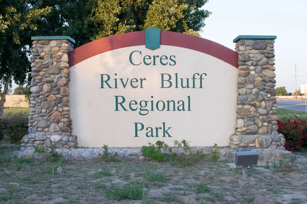
Stone pillars frame the Ceres River Bluff Regional Park entrance sign.
The Hatch Road entrance sign, photographed in May 2016. Photo: Ryanx7 / Wikimedia Commons, CC BY-SA 4.0. Resized.

The Fields Are Above, the Pond Is Below

The city’s park description divides the 76-acre property into two terraces. The upper portion contains the sports facilities, including six dedicated soccer fields. An observation deck overlooks the lower terrace, which stretches toward the river.

For a first visit, park in an open public parking area and follow the designated pedestrian access toward the lower terrace. The county’s half-mile route is a pond walk, not a mileage figure for every trail in the park.

The change in level matters if you are bringing a stroller or helping someone with limited mobility. Ask Ceres Recreation at 209-538-5628 about the best currently open access. Do not assume a route down the bluff has the same surface and slope as the upper sports complex.

A Former Orchard Became a Riverfront Park

The city bought the 76-acre site in 2000 for $1.05 million, according to the Ceres Courier’s account of the park’s development. Much of the lower terrace had been planted in walnuts. Restoring it meant removing the abandoned orchard, bringing back riverside vegetation and connecting trails.

In 2018, Ceres contracted for $1.7 million in restoration work covering 17 acres of former orchard. The work included wetlands, native plantings, paths, picnic tables and a ramp for nonmotorized boats. The plant list included willows, sycamores and cottonwoods, the kinds of trees associated with the river corridor.

The pond has an additional job. A January 2025 city staff report describes it as both a stormwater-retention basin and wildlife refuge. Its PVC liner, installed in 2006, helps hold water through the year instead of letting it seep into the ground.

Why Fishing Is Prohibited in the Pond

Fishing hooks can damage that liner. Ceres adopted Ordinance 2023-1074 on April 10, 2023, prohibiting recreational fishing in the retention pond. When residents later asked the city to reconsider, staff estimated replacing the liner could cost $542,880, before draining the pond or restoring landscaping.

The question did get a follow-up. The Courier reported in January 2025 that councilmembers left the restriction in place after hearing the maintenance concerns. A pond that looks like an inviting fishing spot is also a piece of city infrastructure.

The pond and the Tuolumne River are different waters. The city’s report identifies fishing access at the river dock nearby. Anyone planning a river fishing trip should check California’s current inland fishing regulations and posted restrictions for that location. The river access does not make the pond fishable.

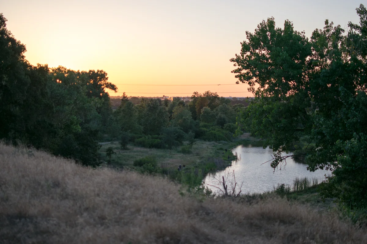
The pond and trees below the bluff at Ceres River Bluff Regional Park in 2016.
A second view of the lower terrace in May 2016, before the later restoration work. Photo: Ryanx7 / Wikimedia Commons, CC BY-SA 4.0. Resized.

Bring Binoculars and Leave Time to Watch

The pond and riverside trees have attracted local birders for years. In the Sierra Club’s May-June 2025 Valley Habitat newsletter, Sal Salerno described a February visit with Daniel Gilman when they saw a Cassin’s Kingbird and a Swainson’s Hawk. Both were notable winter sightings, not a checklist of birds every visitor should expect.

You do not need to identify a rare bird to enjoy the walk. Bring binoculars if you have them, pause at an open view of the pond and give birds room to feed and rest. Keep to the paths and take litter home.

Make It a Daylight Outing

Bring water and shoes that can handle an unpaved path. The lower terrace is in the floodplain, so wet weather and high river levels can affect access. Follow gate signs and closures, and check with Ceres Recreation if your visit depends on a particular trail or river entrance being open.

For a picnic group, the city’s reservable shelter has 15 tables and a large barbecue near the playground. Reserve the shelter through the city rather than assuming it will be available when you arrive.

Have You Walked the Pond Trail?

Tell us what you enjoy at River Bluff Park, or share a tip for someone making their first visit.

Keep Reading

If you would rather stay in town, our Turlock parks guide compares local options. For more short trips, browse the nearby towns guide.

San Luis Reservoir: Three Lakes, a Day Trip and a California Water Story

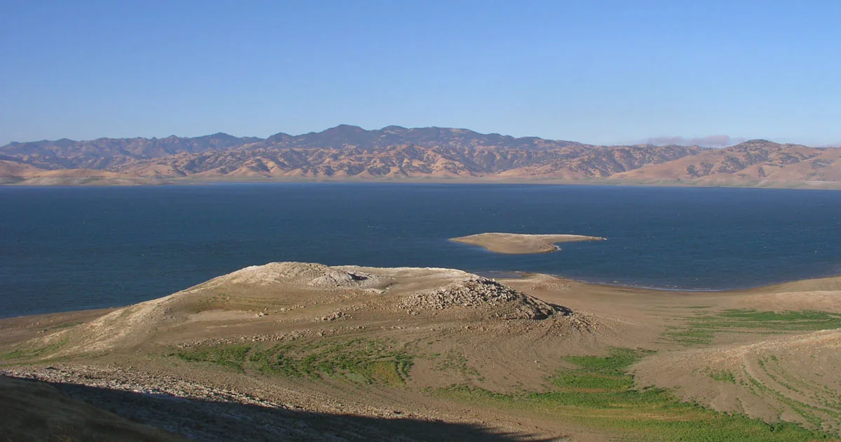
San Luis Reservoir and the eastern Diablo Range, viewed from Romero Outlook.
San Luis Reservoir from Romero Outlook, August 2004. Photo: Clarkma5 / Wikimedia Commons; public domain. Converted to WebP.

The big lake beside Highway 152 is worth pulling off the road for. San Luis Reservoir has a free overlook, fishing, campgrounds and a water story that reaches far beyond Los Banos. For a trip from Turlock, start by choosing which of its three lakes you want to visit. Jump to Getting there · The three lakes · How the water works · The dam’s history · Romero Overlook · Boating and wind · Fishing… Keep Reading

Don Pedro Dam: Turlock’s Water, Two Dams & a Foothill Lake

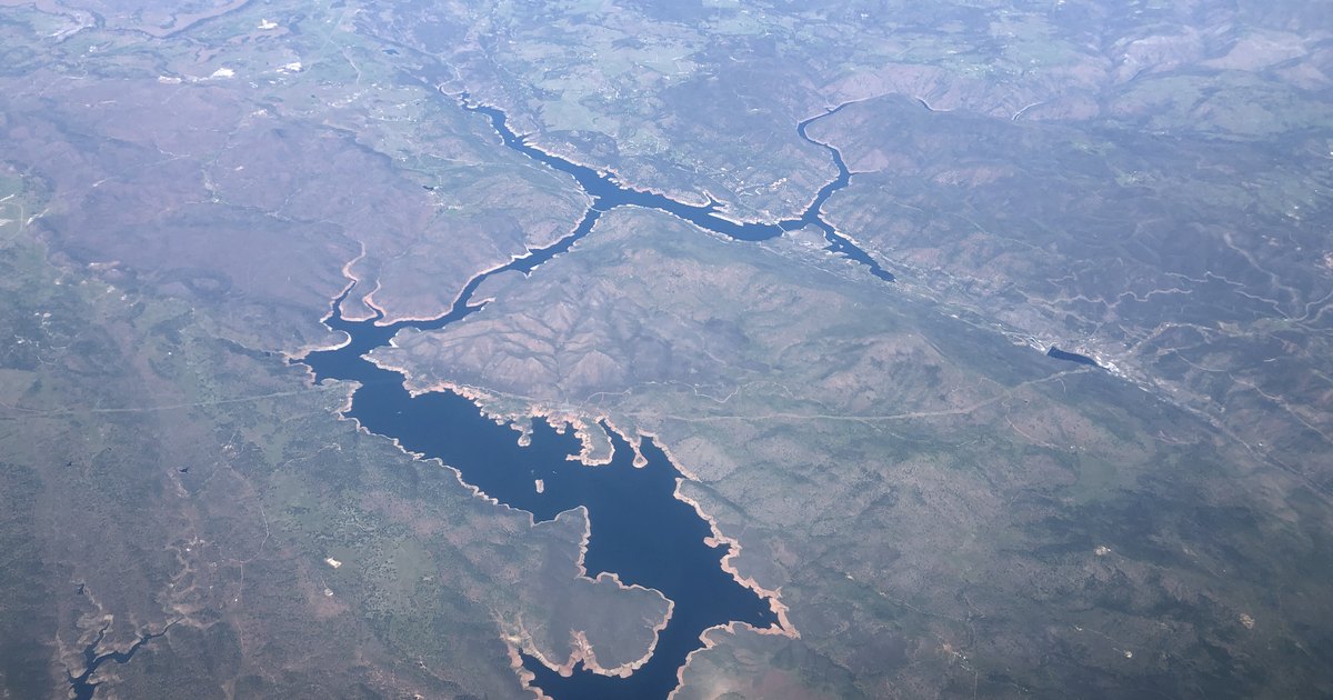
The northern arms of Don Pedro Reservoir winding through Sierra foothills in an aerial photograph
The northern part of Don Pedro Reservoir, March 2022. Photo: Famartin / Wikimedia Commons, CC BY-SA 4.0. Cropped and resized.

Don Pedro has two dams. One holds back the lake you see today; the other normally lies beneath it. The reservoir supplies water for the canals beside Turlock’s streets and the farms around town. Through a separate treatment system, it also supplements the city’s drinking water. On this page: The Turlock connection · Two dams and a vanished town · Water, power and flood control · Where to visit Why a Dam Near La Grange… Keep Reading

Turlock Irrigation District: The Canals That Changed the Valley

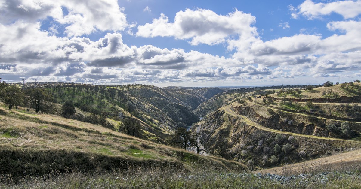
The Tuolumne River gorge and La Grange Reservoir seen from the top of New Don Pedro Dam
La Grange Reservoir viewed from New Don Pedro Dam, 2016. Photo: Ryanx7 / Wikimedia Commons, CC BY-SA 4.0. Cropped and resized.

The canals beside Turlock’s roads are part of the reason the town grew. Before irrigation, much of this valley depended on winter rain and grain farming. In March 1900, water finally reached Henry Stirring’s cornfield near Ceres—a small delivery that marked the start of a much larger change. Turlock Irrigation District had been organized almost thirteen years earlier, on June 6, 1887. It was California’s first irrigation district under the Wright Act. Getting from a… Keep Reading

Smelling Smoke? Winds Pushing Aero Fire Smoke South of Copperopolis

in Public Safety/Environment

Things might get a bit smoky south of Copperopolis due to drift smoke from the Aero Fire.

The Calaveras County Sheriff’s Office says the Aero Fire has burned about 1,000 acres so far. Cal Fire says the blaze sparked in the area of Aero Road and Hunt Road in Copperopolis and is burning at a rapid rate.

Continue reading on ABC10

Turlock Irrigation District’s First Female General Manager to Depart. ‘A Tireless Advocate’

in Environment

Michelle Reimers is resigning as general manager of the Turlock Irrigation District after four years in the job.

The water and power utility announced the decision, effective June 21, in a news release Friday. Reimers was its first female GM and had started there as a public information officer in 2006.

Continue reading on AOL.com

Head-on Crash Near Don Pedro Reservoir Kills Man, Three Women, CHP Reports

in Environment/Public Safety

Four people were killed in a two-vehicle collision Friday, May 31, near Don Pedro Reservoir in Tuolumne County.

The names of the victims were withheld pending notification of family, but a California Highway Patrol release identified them as a Stockton man, 56; a Modesto woman, 66; a Salida woman, 65; and a La Grange woman, 33.

Continue reading on NewsBreak

Swimmer Found Dead After Going Missing at Woodward Reservoir

in Environment/Public Safety

A man who went missing after he tried to swim across a channel at Woodward Reservoir on Sunday afternoon was found dead, deputies said.

The Stanislaus County Sheriff’s Office said the man went missing near Mountain View Point at Woodward Reservoir sometime after 2 p.m.

Continue reading on NewsBreak

1 2 3 … 16
Go to Top