Category archive

Weather - page 6

Local forecasts, heat, storms and weather impacts.

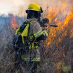
California Wildfire Map, Updates on Loyalton Fire, Brentwood Fire, Azusa Fire

in Weather

California is experiencing several major wildfires amid a record-breaking heatwave. Thousands of acres have been burned and evacuation orders are in place across various counties, including Los Angeles and Monterey.

The National Weather Service forecasts that the heatwave will continue across the west coast of the U.S. for the next few days, with excessive heat warnings and heat advisories in place.

Record high temperatures are forecast and the persistent heat and dry conditions will also promote wildfires across the region. Additionally, thunderstorms could produce dry lightning that could lead to the development of additional fires.

Continue Reading on News Week

Heat Wave: Local Cooling Centers and Spaces

in Weather

SACRAMENTO (CBS13) — As we prepare for a potentially record-setting heat wave in both the Sacramento and northern San Joaquin valleys, cooling centers are opening to help the most vulnerable.

Forecasters are warning that the Central Valley is in for an extended heatwave that could push Sacramento close to its hottest temperature ever. Temperatures are expected to reach into the mid to high 100s through the weekend. An Excessive Heat Watch is set to go into effect on Friday.

We checked in with several counties, including Stanislaus, where cooling centers in Ceres, Modesto and several other areas are open.

Continue Reading on Sacramento CBS local

Broiling Temperatures in L.a. County, Inland Empire Expected to Last Through Monday

in Weather

Searing temperatures in inland areas of Southern California are expected to last through Monday, extending the suffering for vulnerable and unhoused people across the region who have nowhere to escape the heat.

“It’s been a miserable week,” said Paul Read, co-founder of the homeless services provider Passion, which does outreach in the San Fernando Valley. “People don’t want to go out in the heat. They’re getting dehydrated.”

Temperatures have hit triple digits in the Antelope Valley cities of Lancaster and Palmdale, as well as in parts of Riverside County, where the Apple fire has burned more than 4,100 acres. The broiling weather is expected to continue through Sunday, easing slightly on Monday and cooling later in the week, according to National Weather Service meteorologist Lisa Phillips.

Continue Reading on KTLA 5

Grant to Help Turlock Transit Weather Pandemic

in Weather/Business & Economy

The City of Turlock has been awarded a $5.5 million grant  from the Coronavirus Aid, Relief and Economic Security (C.A.R.E.S.) Act to support Turlock Transit operations during the COVID-19 public health emergency.

The funding was actually $6.4 million and was for the Turlock Urbanized Area, which includes part of Merced County. The City had a previously adopted agreement with Merced County that will allocate 14.27 percent of the funds to them, which amounts to $921,504 and leaves Turlock with $5,536,129, said Turlock Transit Manager Wayne York.

Turlock Transit’s portion of the grant will be used to pay for all regular transit operating expenses incurred over the year, including contracted labor, fuel, and maintenance services. It will also be used to fund expenses specifically related to COVID-19 including: The purchase of cleaning materials and personal protective equipment; staff time for enhanced cleaning of buses and facilities; additional transit services to help maintain social distancing on-board buses; and administrative leave for transit staff affected by service reductions, isolation, or quarantine.

“We are grateful for CARES Act transit funding because it’s provided us with the resources to maintain transit for our community while securing the necessary equipment and services to keep our buses clean and passengers safe,” York said. “It also allowed us to suspend fare collection for three months to require rear-door boarding and improve social distancing between drivers and passengers. In addition to public health benefits, this provided financial relief to our passengers during these uncertain times.”

Continue Reading on Turlock Journal

Get Ready, Stanislaus County. At Least 6 Days of Triple-Digit Heat Expected This Week

in Weather

The National Weather Service has issued an excessive-heat watch for all across Stanislaus County for Monday through Saturday because of triple-digit heat and warm nights.

“Moderate to very high heat risk is expected during this time frame, which means there’s an increased risk for heat-related illness,” the Sacramento office of the weather service said in a news release Sunday. “… Overnight low temperatures are forecast to be in the 60s and 70s, which means some areas could see poor overnight relief.”

The forecast for Modesto, which is very similar to those of other local communities, is for highs near 100 degrees Monday, and 101 Tuesday through Saturday. Overnight lows are expected to be 69 or 70 degrees.

The West Side of the county is expected to get the highest highs of the week, reaching near 102 in Patterson on Wednesday and again on Saturday.

Continue Reading on The Modesto Bee

Wildfire Danger: Red-Flag Warning from Delta to Sierra Foothills

in Weather

A red-flag warning, indicating elevated wildfire conditions, has been issued by the National Weather Service for a swath of Northern California including the Carquinez Strait.

The warning is in effect from 11 p.m. Sunday to 8 p.m. Monday.

It extends from the Sacramento-San Joaquin River Delta to the northern San Joaquin Valley and the southern Sacramento Valley, comprising parts of the counties of Solano, Yolo, Sacramento, San Joaquin, Stanislaus and Sutter.

Dry north to northwesterly winds of 15 to 20 mph are forecast, with gusts up to 30 mph. Humidity during the day is expected to be 10 to 13 percent.

Continue Reading on Mercury News

Heat Wave Hits Turlock

in Weather

While summer is still a month away, its triple-digit heat has already arrived.

The National Weather Service issued an Excessive Heat Warning for parts of Northern California this week — including the Turlock area — which went into effect at 11 a.m. Monday and will last through 7 p.m. Thursday. Daytime highs have been in the triple figures this week, with temperatures expected to reach 107 on both Wednesday and Thursday.

Noted by the NWS as the first significant heat wave of the year, overnight temperatures have also remained warm and will continue to offer little relief from the high temperatures for the remainder of the week. A large dome of high pressure that is building up and expanding across the state caused the heat wave, according to NWS.

Continue Reading on Turlock Journal

State Releases Draft of Water Resilience Plan

in Weather

State agencies released a new water planning document that contains a number of recommendations to help California cope with more extreme droughts and floods, rising temperatures, declining fish populations, aging infrastructure and other challenges.

The California Natural Resources Agency, California Environmental Protection Agency and California Department of Food and Agriculture developed the full draft of the water resilience portfolio, fulfilling Gov. Gavin Newsom’s April 29 executive order calling for a portfolio of actions to ensure the state’s long-term water resilience and ecosystem health.

Continue Reading on Turlock Journal

Heavy Rains to Remain Off Southern California Coast

in Weather

SAN DIEGO (CNS) – Another cold storm was headed to San Diego County late tonight and through Monday night, but heavy rain will remain offshore, and some light rain and mountain snow is possible on Monday, forecasters say.

A winter storm warning was likely to be discontinued later Sunday, the National Weather Service in San Diego said in a release issued at 9:36 a.m. “The models are beginning to gel regarding the track of the system dropping south off the coast,” the weather service said.

Continue Reading on ABC 10 NEWS

Atmospheric River Brings Abundant Rainfall

in Weather

Stormy weather swept through the region last week and throughout Thanksgiving weekend, providing some much-needed relief after the autumn season opened with weeks of dry weather.

The Turlock area on average received over 2.5 inches of precipitation since last week, according to data provided by Turlock Irrigation District, while the Tuolumne River Watershed received over five inches — nearly an inch more than the watershed’s historical average for the entire month of November. The precipitation came after the region received just .32 inches of rain Sept. 1 through Nov. 24.

Continue Reading on Turlock Journal

Go to Top