
A TOWN IN CHANGE · 1870s–2020s
Turlock’s history is still visible in the route through town: railroad tracks beside downtown, canals across the valley, a college campus in the north and shopping centers near the freeway. They belong to different decades—and each changed what people came here to do.
This chronology follows those local changes, including places that disappeared and institutions that found a new use. For the longer stories behind individual people and communities, use the main history page and its linked profiles.
Updated 2026.
- 1870s–1890s: railroad, land and water
- 1900s–1930s: a city builds its institutions
- 1940s–1970s: wartime confinement, invention and a college
- 1980s–2020s: shopping, preservation and the modern city
Before 1871: a longer history on this land
The founding date marks the railroad settlement. Stanislaus State acknowledges its campus as traditional, unceded Yokuts land. The people and history of the region did not begin when a depot appeared. The opening chapter of Turlock’s history places that earlier story beside the city’s later growth.
1870s: a grain warehouse becomes a town
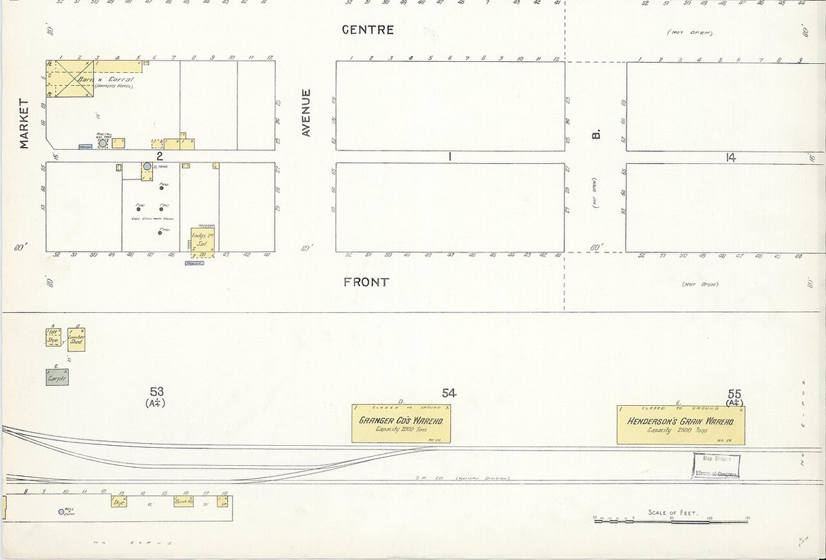
The city records December 22, 1871 as Turlock’s founding date. John William Mitchell’s grain warehouse, the depot, a post office and a few other buildings formed the beginning of the settlement. The Historical Society’s railroad display connects those buildings to Mitchell’s wheat-growing landholdings and the railway’s southward expansion.
The essential business was moving a harvest. The depot brought customers, workers and new families to a place where crops could be shipped out. Today’s Golden State Boulevard and downtown blocks still follow that railway geography.
1880s: farmers organize around water
Turlock Irrigation District was formed on June 6, 1887, becoming California’s first irrigation district. A district could organize a shared water system at a scale that individual farms could not. Its formation began years of construction, financing and disagreement before the dependable deliveries growers wanted.
The change would eventually make a wider range of crops practical. Dry-farmed grain depended heavily on well-timed rain; canals opened the possibility of orchards and smaller farms. Water became a public institution in the region, as important to its future as the railway had been to its beginning.
1890s: a dam and smaller landholdings
Turlock and Modesto irrigation districts completed La Grange Dam in 1893. Its job was to raise the Tuolumne River’s level and divert water into canals. The later storage reservoirs would solve a different problem: keeping water available across dry seasons.
Around the same time, Mitchell’s estate was being divided into 20- to 40-acre tracts, according to the Historical Society’s account. The land pattern was changing alongside the water system. A place associated with extensive wheat holdings was being prepared for more families and different farming routines.
1900s: irrigation reaches a farmer, and Turlock becomes a city
TID’s historical milestones name Henry Stirring as its first farmer to receive irrigation water in 1900. The Historical Society records a substantial influx of settlers in 1903 and 1904, drawn by land and the promise of irrigation. The canals gave those promises a working form.
The town’s institutions grew with it. Turlock High School began in 1906, initially teaching classes in the town hall; its first school building followed in 1907. Turlock incorporated on February 15, 1908. That year also brought the first free city library, organized through the Women’s Improvement Club, according to the county library’s history.
1910s: the melon carnival, a library and a hospital
The first Turlock Melon Carnival in 1911 promoted the region’s melon industry and shipping trade. It joined business promotion with a public celebration, giving the local harvest a place on the town calendar. The event later evolved into the county fair.
The Greater Turlock Civic Club secured the site and helped bring the Carnegie Library to its September 1916 opening. Emanuel Hospital opened on Canal Drive in June 1917, recorded in the county’s centennial commendation. These were investments in reading, health and community life as well as buildings. The Canal Drive guide follows the hospital’s former neighborhood.
1920s: bigger civic buildings, public power and racial exclusion
The historic high school grew in stages: classroom wings in 1922 and 1923, followed by the auditorium in 1925, according to its National Register nomination. In 1923, the original Don Pedro project brought storage and the start of TID’s public electricity service. Water and power were now connected parts of the regional infrastructure.
The decade also includes a violent episode in the agricultural town. On July 19, 1921, white vigilantes forced 58 Japanese laborers out of Turlock by truck at gunpoint, documented in Densho’s timeline. The history of exclusion explains the local tensions and discriminatory policies surrounding Japanese growers and workers.
1930s: the fair becomes an agricultural institution
Livestock exhibitions entered the fair’s programme in 1933 through 4-H and FFA. In 1935, the state chartered the 38th District Agricultural Association, the governing body that remains associated with the fair. The fair’s official history follows that transition from a revived local carnival into an established agricultural institution.
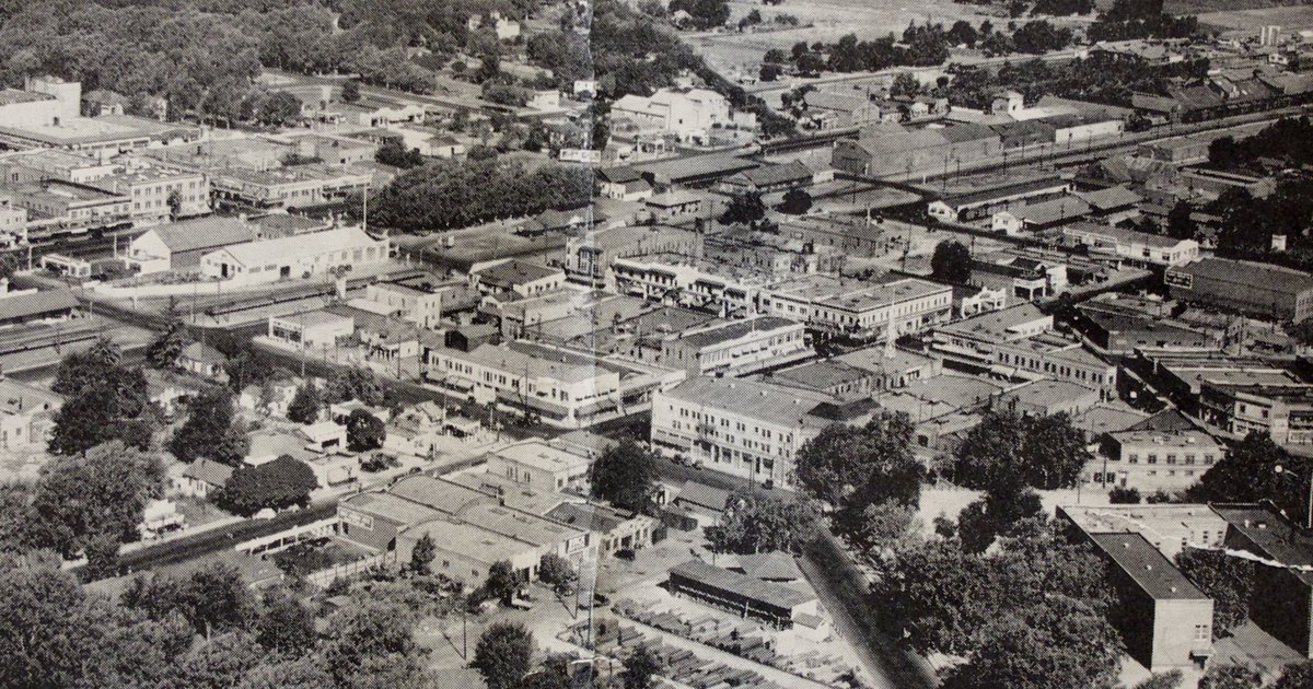
The 1936 aerial photograph above shows the older town packed around the railway and its principal streets. It offers a useful comparison with the much larger footprint of today’s Turlock. Look at the short blocks before exploring Main Street or the Westside: some of the town’s earlier scale survives in those connections.
1940s: the fairgrounds become a detention site
From April 30 to August 12, 1942, the fairgrounds operated as the Turlock Assembly Center. More than 3,600 Japanese Americans were incarcerated there after forced removal from their homes. Densho’s facility history identifies groups brought from Solano County, the East Bay, Los Angeles and Walnut Grove, then transferred to Gila River in Arizona.
The fairground name can hide that geography: many people imprisoned here had come from far beyond Turlock. The site’s later fairs and college classes occupy the same ground. Knowing those successive uses makes a present-day visit more complete; the detention history is part of the place, rather than a separate story elsewhere.
1950s: a Turlock family creates MedicAlert
After Linda Collins experienced a dangerous allergic reaction in 1953, her parents Marion and Chrissie sought a durable way to communicate medical information. The foundation’s account traces their work to the first medical ID and MedicAlert’s formation in 1956. A family problem in Turlock became a service used far beyond the city. The Collins family profile follows the people behind it.
Other familiar names took shape in this decade. Latif’s opened in 1953, before moving to its current building in 1960. In 1956, the name Stanislaus County Fair first appeared on the fair marquee. A diner and a fair name became part of the everyday town residents still recognize.
1960s: the college moves north
Stanislaus State College began classes at the county fairgrounds on September 19, 1960. Its first commencement in 1961 awarded 25 degrees at Turlock High School. In 1965, classes moved to the permanent campus. The university’s chronology makes the short journey between those three local settings visible.
Other institutions relocated too. Emanuel’s Delbon Avenue campus opened in 1966, and the public library moved from the Carnegie to Minaret in 1968. The Geer Road guide follows the commercial corridor beside the university; older east Turlock traces the earlier hospital and school area.
1970s: more storage, and another life for the Carnegie
New Don Pedro was completed in 1971, with substantially more water storage than the original reservoir. Its importance reached the farms and city beyond the foothills. The canals running through the region were connected to a much larger reserve upstream.
In town, the former library became an arts center in 1979, a change recorded in the Carnegie’s own history. The public building found a new purpose after the library moved. Preserving a place sometimes meant changing what happened inside it.
1980s: Geer’s shopping corridor comes into focus
Olde Tyme Pastries opened in Geer Gardens on May 1, 1981, according to the Journal’s anniversary account. Turlock Town Center at Geer and Golden State followed in 1986, with a grocery-anchored format described in the center’s history. Both help explain why Geer became a familiar destination for everyday shopping.
In the mid-1980s, Stanislaus State gained university status, recorded in its institutional chronology. Growth was changing the north side’s purpose as well as its storefronts. The Geer Road profile separates today’s destinations from the older tenant names residents remember.
1990s: planning the northwest, and restoring an old stage
The city adopted the Northwest Triangle Specific Plan in 1995 for approximately 800 acres between Golden State Boulevard, Highway 99 and Fulkerth Road. It provided a framework for the retail growth visitors now encounter around Countryside Drive and Monte Vista.
On campus, Marvalene Hughes began her 1994–2005 presidency, remembered in the university’s account of her leadership for expanded enrollment and facilities. Downtown’s older civic buildings also received attention: the historic school auditorium’s major restoration was completed in 1999. The Hughes profile and theatre history follow those separate kinds of development.
2000s: a new retail destination and a second high school
The first phase of Monte Vista Crossings was completed in 2001 after construction began in late 2000. The Journal’s development history describes agricultural land becoming a regional shopping destination. In August 2002, more than 1,000 students began classes at the new Pitman High School, whose school history traces its funding to a 1997 voter-approved measure.
Growth and preservation happened together. The Carnegie’s interior was destroyed by fire in November 2005, leaving the exterior walls. The city and foundation chose to preserve and expand it. The Countryside and Walnut Road pages show the newer shopping and school districts that grew during this period.
2010s: restoration and new destinations
The rebuilt Carnegie Arts Center reopened in September 2011. Its old walls remain visible beside the new addition at 250 N. Broadway. A visitor can see both the original building and the decision to keep it useful.
Dust Bowl’s larger brewery and taproom opened in 2016 at 3000 Fulkerth Road, adding a destination restaurant and beer garden to the freeway side of town. In 2018, the city named the transit center for Roger K. Fall, whose work had helped move the transfer point from Central Park. The boulevard’s transport history kept changing.
2020s: larger employers and a new water source
Amazon’s fulfillment center on Fulkerth Road opened in 2022, recorded in the Journal’s year in review. The university opened its new Student Center in 2020 and completed its library renovation in 2022, updating a campus that had moved north more than half a century earlier.
The Regional Surface Water Supply Project began delivering treated Tuolumne River water to Turlock and Ceres in November 2023, according to the State Water Board. In August 2026, the city awarded the Geer Road rehabilitation contract. Water and transport remain local questions, even as their systems become more complex.
Find a decade in today’s town
Start at the Historical Society Museum, 108 S. Center Street, for photographs and displays that restore older names to familiar streets. Then use the areas and streets directory to follow one part of the story: Main Street’s storefronts, Canal Drive’s institutions, Geer’s shops or Countryside’s newer retail landscape.
History of Turlock · People and family profiles · Turlock Guide
