
Last updated
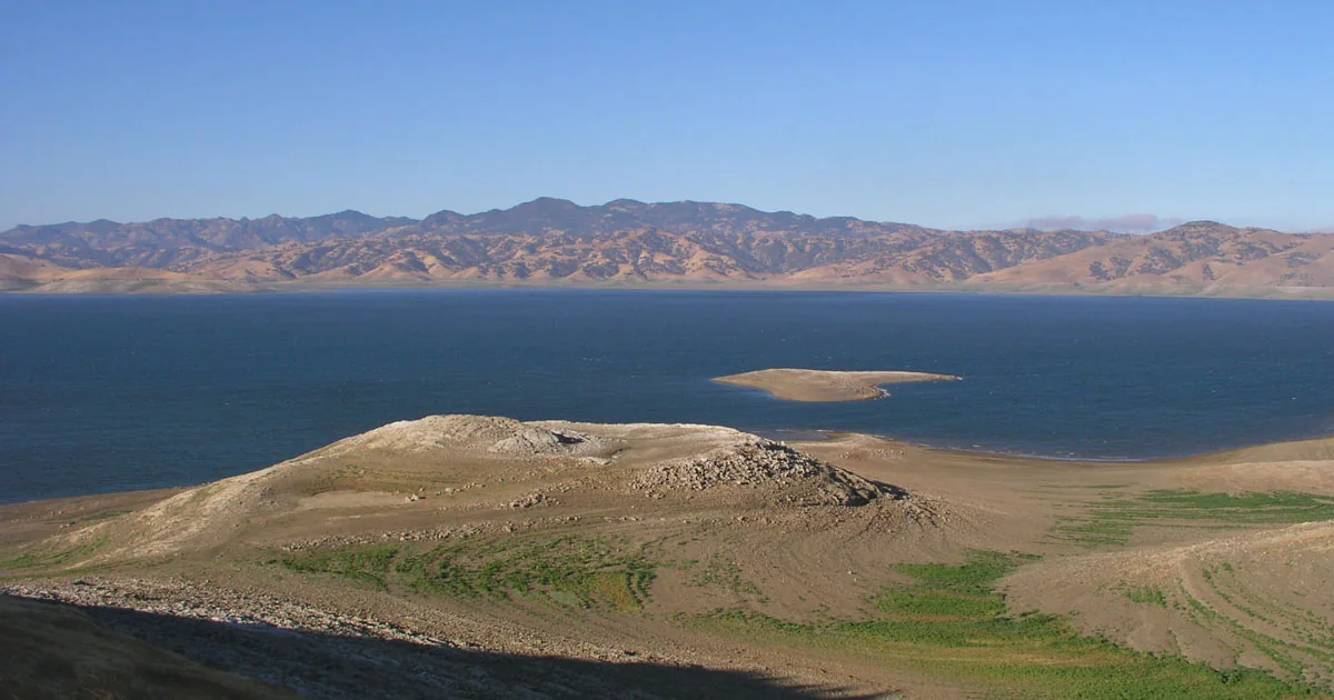
The big lake beside Highway 152 is worth pulling off the road for. San Luis Reservoir has a free overlook, fishing, campgrounds and a water story that reaches far beyond Los Banos. For a trip from Turlock, start by choosing which of its three lakes you want to visit.
Jump to Getting there · The three lakes · How the water works · The dam’s history · Romero Overlook · Boating and wind · Fishing and swimming · Camping · Walks and nearby stops.
West of Los Banos, on the way to Pacheco Pass
The main reservoir is about 12 miles west of Los Banos. Highway 152 follows its northern side as the road heads toward Pacheco Pass and Gilroy. From Turlock, Highway 165 takes you through Hilmar and Stevinson toward Los Banos; turn west onto Highway 152 for the main lake. The public entrances lead to several quite different places around the water.
For a first visit, set your directions to Romero Overlook. A boat trip needs directions to the launch itself; a campsite reservation needs the campground name. “San Luis Reservoir” alone is too broad a destination for either.
The state recreation area is seven miles west of Interstate 5 on Highway 152. Its park page lists day-use vehicle admission at $10 on regular days and $12 on selected holiday, seasonal and weekend dates. Park and boating hours run from 6 a.m. to sunset.
Three lakes, three different outings
- San Luis Reservoir: the large lake held behind B.F. Sisk Dam, with open-water boating, fishing and the Romero overlook. Its shoreline and ramps change with storage levels.
- O’Neill Forebay: the lower lake beside the dam and the canals. San Luis Creek and Medeiros offer camping here; North Beach has the recreation area’s designated swimming area.
- Los Banos Creek Reservoir: a separate lake reached from Canyon Road, south of Highway 152. Its slower boating rules and smaller camping area create a different visit from the main reservoir.
A forebay is a smaller reservoir used to manage water moving through a larger system. O’Neill is part of the pumping and delivery machinery at San Luis. Los Banos Creek Reservoir was built to keep storm runoff from damaging the canals; it is not the smaller lake immediately below B.F. Sisk Dam.
Why water is pumped uphill into this lake
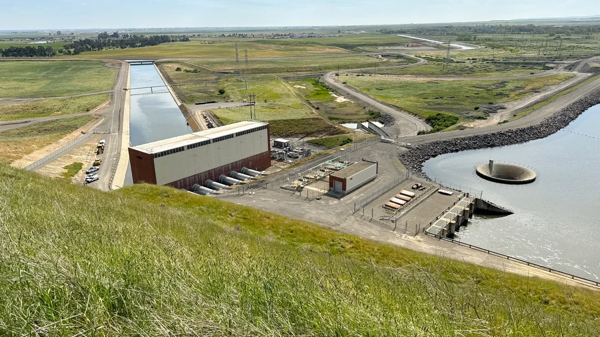
San Luis is an offstream storage reservoir. The name describes how it is filled: much of its water arrives through California’s canal system and is pumped into storage. The Bureau of Reclamation’s engineering account explains the route. Water from the California Aqueduct and Delta-Mendota Canal reaches O’Neill Forebay, then moves uphill into San Luis Reservoir through the Gianelli Pumping-Generating Plant.
When water is released in the other direction, the same plant can generate electricity. The reservoir gives the water projects somewhere to hold supplies before they are needed farther south. Its water level therefore reflects deliveries and pumping as well as the weather. A dry-looking shoreline is not a simple rainfall gauge.
This is a joint federal-state facility: the Bureau of Reclamation owns the dam, while the California Department of Water Resources operates it. Its storage allocation is 55 percent state and 45 percent federal. The stored water supports farms, communities and wildlife habitat south of the Delta.
Turlock’s own canal story is covered in our Turlock Irrigation District history. Don Pedro is another major reservoir familiar to local residents, on the Tuolumne River. These are different water systems; San Luis belongs to the federal Central Valley Project and California State Water Project.
Kennedy came here before the lake existed
President John F. Kennedy led the dam’s groundbreaking ceremony on August 18, 1962. The Bureau of Reclamation has made film of his speech available. It shows the gathering at the beginning of the project, before the reservoir became the familiar blue expanse beside the highway.
Construction of the dam ran from 1963 to 1967. The earthfill embankment is 382 feet high and more than 3.5 miles long. Reclamation identifies San Luis as the nation’s largest offstream reservoir, with capacity above two million acre-feet. One acre-foot is enough water to cover an acre of land one foot deep.
The dam was originally called San Luis Dam and is now B.F. Sisk Dam. The seismic-safety work now underway adds stability berms and raises the crest by 10 feet to reduce the risk of overtopping if the dam slumps during a large earthquake. The Ortigalita Fault crosses the reservoir. Construction began in 2022, and Reclamation’s published schedule places completion of the final phase in 2032.
A separate reservoir-expansion project approved in October 2023 would add another 10 feet to the dam and create 130,000 acre-feet of additional storage. The safety project and the storage expansion have different purposes: strengthening the existing dam is one job; making room to hold more water is another.
The work affects recreation. The Basalt campground and day-use area have been closed since May 31, 2022 for the dam project, and the Basalt boat ramp is closed. Use the open areas around O’Neill Forebay or Dinosaur Point for the activities permitted there.
Romero Overlook: the easiest first stop
The Romero Overlook Visitors Center sits above the main lake, just off Highway 152. Admission is free. DWR’s location-specific page lists Thursday through Monday, 9 a.m.–5 p.m., with Tuesday and Wednesday closures except major holidays. For the indoor exhibits, call (209) 827-5353.
The center’s exhibits and videos explain the reservoirs and the State Water Project. DWR offers free school and community-group tours by reservation, with materials available for teachers planning a field trip.
Spring brings green hills and wildflowers; summer usually brings brown grass, strong sun and days averaging in the mid-90s, sometimes above 100 degrees. Winter tule fog can limit the views. A shoreline picnic and a long hill walk call for different preparation. Bring drinking water and sun protection, and use the day’s forecast when deciding how far to walk.
Boating here means watching the wind
Wind can change quickly on these lakes. The park’s warning lights are part of the operating rules: amber means caution; red means the lake is closed to boating and vessels must leave immediately. Main-reservoir lights are at the Basalt entrance, Quien Sabe Point and Romero. Forebay lights are near the old Medeiros ramp and above South Beach.
- Main reservoir: launch at Dinosaur Point. The Basalt ramp is closed. Stay at least 500 feet from the dam and intake structure.
- O’Neill Forebay: the operating boat ramp is at San Luis Creek. Shallow water along the southern shore and marked areas requires care. Boats are prohibited at North Beach.
- Both lakes: changing water levels can expose hazards. Boating ends at sunset; allow time to retrieve your boat.
California’s Boater Card program now covers motorized-vessel operators of all ages, subject to its listed exemptions. Complete the approved safety course and check which requirements apply before bringing a motorboat. Rental-vessel and other exemptions have specific rules.
The park’s mussel-screening program requires watercraft to arrive clean, drained and dry for inspection before launch. Allow time for that check before heading to the ramp.
Golden mussels were detected in the main reservoir in 2025. The state’s October 2025 notice announced mandatory inspections for vessels leaving San Luis Reservoir. A March 2026 notice for O’Neill Forebay confirmed golden mussels there too. Clean, drain and dry boats and equipment after use, and follow the inspection staff’s instructions before taking them to another lake.
DWR’s San Luis Reservoir station and O’Neill Forebay station report changing storage levels. Use the park’s current launch notice alongside those readings when planning a boat trip.
Fishing, a picnic or a swim
Striped bass are a major draw at the main reservoir and forebay. The park’s fishing information also lists largemouth bass, crappie, shad and perch. North and South Beach at San Luis Creek have picnic tables, shade ramadas, grass, drinking water and flush toilets. North Beach is the only designated swimming area in the recreation area, and no lifeguards are on duty.
For anglers 16 and older, a California sport-fishing license is generally required. CDFW offers one-day and other short-term licenses as well as a 365-day license. Its current fishing regulations set species, size and bag limits.
Where to camp—and which area is closed
The campgrounds have very different facilities. San Luis Creek, on O’Neill Forebay, has water and electric hookups and a dump station for registered campers. Some sites border the shoreline. It has little shade, is exposed to wind, and its regular campsites do not have flush toilets or showers. Reservations are available through ReserveCalifornia.
Medeiros, along the forebay’s southern shore, is a more basic first-come, first-served option. A limited number of tables, fire rings and shade ramadas are available, with drinking water at three locations and chemical toilets. Check the park’s current fire restrictions before cooking or lighting a fire.
Los Banos Creek: open again, with low-water limits
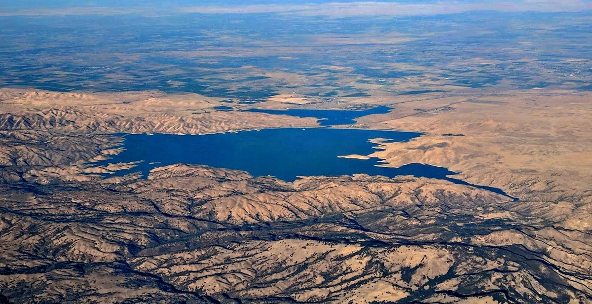
The separate Los Banos Creek Reservoir is at 20800 Canyon Road, Los Banos. State Parks’ September 30, 2026 notice says it has reopened, but extremely low water prevents launching vessels from the ramp. Hand-carried kayaks, canoes, paddleboards and small watercraft are allowed.
The whole lake has a 5 mph limit. The park lists bass, crappie and bluegill fishing, with trout stocking in winter. Its shoreline camping is basic, with chemical toilets; the location-specific page says no drinking water is available. Bring your own supply. For water-level and lake-condition questions, the reopening notice gives San Luis Water District’s number, (209) 826-4043.
Walk the shore, or head into Pacheco’s hills
At O’Neill Forebay, the San Luis Creek shoreline trail provides an accessible walking route between campground and day-use areas. The accessible-features page identifies the route’s surfaces, parking and restrooms, which helps when planning around a wheelchair or limited mobility. Pick a shorter out-and-back walk if you want a look at the water without committing to the whole shoreline.
For a hillier outing, Pacheco State Park is west of the reservoir at 38787 Dinosaur Point Road, Hollister. Its open grasslands and oak trees offer hiking, horseback riding and mountain biking, with spring wildflowers and wide views. Only the western portion of the park is open to the public. Bring drinking water: the park reports no potable supply for visitors. Dinosaur Lake Trail is closed until further notice.
There is a direct historical connection between that park and the lake. Paula Fatjo, a fifth-generation Pacheco descendant, restored and lived in the family adobe before reservoir construction took much of the ranch. The adobe broke apart during an attempted move; its remains are near the ranch headquarters. Fatjo deeded the last 6,890 acres of the ranch to the state in 1992. The park’s illustrated history explains that story and identifies old stage-route and ranch features.
The guided Path of the Padres hikes were canceled for 2026 because of the Los Banos Creek water-storage project. That program notice concerns the guided hike; it is separate from the lake’s September reopening.
A wildlife stop on the Los Banos side
The similarly named San Luis National Wildlife Refuge is a separate destination northeast of the reservoir. Its entrance is at 7376 S. Wolfsen Road, Los Banos. The refuge’s visiting page gives directions south from Turlock on Highway 165 through Hilmar and Stevinson. There is no fee for its visitor center, auto-tour routes or nature trails.
Two driving tours offer quite different wildlife viewing: an 8.5-mile Waterfowl route through wetlands and uplands, and a five-mile Tule Elk route around the resident herd’s enclosure. Autumn through spring brings large concentrations of ducks, geese and sandhill cranes. The routes are for vehicles; use the signed trailheads when you want to walk. A refuge visit fits particularly well with a cool-season trip, when the birds and green hills offer alternatives to swimming.
For the road’s older story, read our Highway 152 and Pacheco Pass history. The nearby-towns directory covers other outings from Turlock. For park access, launches and campground questions, the San Luis Reservoir office number is (209) 826-1197.
