
Last updated
The reservoir beside Highway 152 looks as though it has always been there. It hasn’t. Before San Luis Reservoir filled, this was ranch country; before cars crossed Pacheco Pass, travelers paid a toll and stagecoaches worked their way through the hills.
From Turlock to Los Banos
Olive Avenue connects with Lander Avenue at downtown Turlock. Follow Lander south and, beyond Highway 99, the state-highway portion is Highway 165, serving Hilmar, Stevinson and Los Banos. The city’s road plan explains that connection. In Los Banos, Highway 152 runs east–west as Pacheco Boulevard, as shown in the city’s planning documents. Get directions from Turlock to Los Banos via Hilmar.
Westbound from Los Banos, 152 meets Interstate 5, passes the San Luis water-project landscape and crosses Pacheco Pass toward Gilroy. Beyond Gilroy, the route continues toward Watsonville through Hecker Pass. Eastbound from Los Banos, it continues across the valley to Highway 99.
The Turlock–Los Banos connection has its own engineering story. A May–June 1961 highway report, pages 43–44, describes the newly completed 17.4-mile road north from Los Banos. Seasonal flooding had long complicated construction. The project included three reinforced-concrete bridges across the San Joaquin River area, making a direct, year-round connection possible.
A crossing older than California’s highways
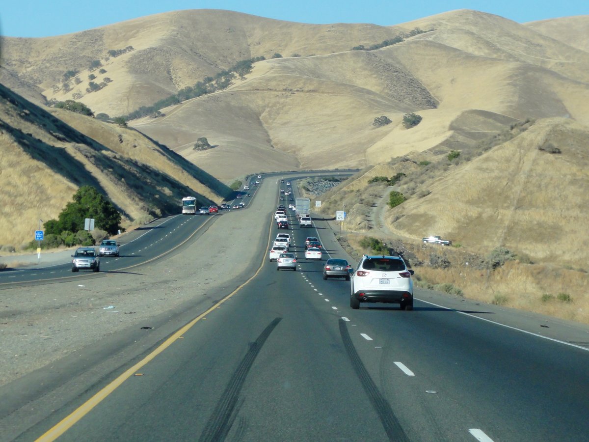
Pacheco Pass followed a Native route between the Central Valley and the coast. Its name comes from Francisco Perez Pacheco, a Mexican-era rancher whose family’s land extended through these hills. Andrew Firebaugh developed a toll road in the mid-1850s; Butterfield Overland Mail stagecoaches used the crossing from 1858 to 1861. The pass became a link in a mail route connecting California with Missouri.
You can still find traces of those earlier roads. State Parks’ Pacheco hiking guide points out toll-road remnants, a paved roadbed from the 1920s and Dinosaur Point Road, which carried Highway 152 until 1965.
John Muir crossed the pass in 1868 and described his first view of the Sierra Nevada from its summit:
“Then it seemed to me the Sierra should be called, not the Nevada or Snowy Range, but the Range of Light.”
John Muir, quoted in the State Parks hiking guide
The lake that changed the landscape
San Luis Reservoir is part of California’s plumbing. It stores water diverted from the Sacramento–San Joaquin Delta, shared by the state and federal water projects. Water is pumped up from O’Neill Forebay and later released through the pumping-generating plant. The Department of Water Resources dates construction to 1963–1967 and the reservoir’s filling to 1969.
The project also changed a family home. Pacheco descendant Paula Fatjo restored and lived in the old Pacheco adobe before land was taken for the reservoir. An attempt to move the adobe left it in ruins. In 1992, Fatjo gave the remaining 6,890 acres of her ranch to the state; that land became Pacheco State Park. The park’s history connects the reservoir, the ranch and the family behind the name.
Three stops with a reason to get out of the car
- Romero Overlook: the Pacheco Pass historical landmark is at 31770 W. Highway 152, Los Banos. It is a place to see the reservoir and read the landmark’s short account of the crossing.
- Pacheco State Park: 38787 Dinosaur Point Road, Hollister. The park preserves grassland, oak woodland and trails above the reservoir.
- Casa de Fruta: 10021 Pacheco Pass Highway, Hollister. Its family history begins with orchards planted in 1908 and a cherry stand opened by the Zanger brothers in the 1940s. Today the fruit stand sits alongside food, shops and family attractions.
For a coast-bound trip, check Caltrans QuickMap and Highway 152 conditions before leaving. Wind advisories are particularly relevant to trailers and campers on Pacheco Pass.
Related: Highway 99’s Turlock history · West Main Street’s connection to Patterson and I-5 · history of Turlock · Turlock Guide.
