
Updated 2026.
Patterson’s streets point toward a small building in a circle. That unusual downtown plan is a good reason to get beyond the freeway exits and see the older city. Apricot traditions, a local history museum and the road into Del Puerto Canyon give this westside community a character of its own.
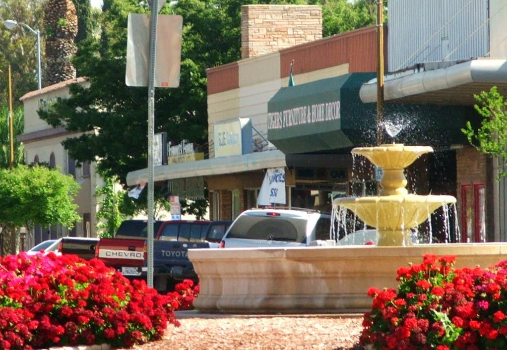
Across the valley from Turlock
Patterson is an incorporated city in western Stanislaus County, toward Interstate 5. From Turlock, the city’s directions send drivers west on West Main Street; the approach continues across the San Joaquin River toward Las Palmas Avenue. The drive crosses the valley to its west side. Use directions to downtown Patterson for the route from your starting point.
Why the streets form spokes
The city’s historical account follows the land from the 1844 Rancho Del Puerto grant to John D. Patterson’s purchase in 1866. After his death, the Patterson Ranch Company acquired the property in 1908. Thomas W. Patterson then laid out a town with circles and radiating streets, drawing inspiration from Washington, D.C., and Paris.
The colony map was filed on December 13, 1909. Patterson incorporated on December 22, 1919. The street pattern survives in the center of town: the Downtown Master Plan describes eight streets radiating from Plaza Circle. It also identifies South Third Street and South Del Puerto Avenue as corridors of older commercial buildings. The circle and its spokes are a good place to begin a downtown walk.
Start at the Center Building
The Patterson Township Historical Society Museum occupies the Center Building at 300 West Las Palmas Avenue, inside Plaza Circle. Completed in 1910 as the Patterson Ranch Company Office, it originally served the sale of farms, businesses and town lots. The place that helped sell the new settlement now preserves its history.
The society’s annual publication, The Gateway, began in 1978 and covers local families, businesses, clubs and events. It is a useful lead for anyone researching a westside family connection. Contact the society about a museum visit; its website provides docent and curator contacts. Outside, the Center Building makes the town’s plan easy to understand: the circle is the starting point, and the surrounding streets spread outward from it.
Nearby North Park and Veterans Memorial Park frame the Las Palmas entrance to downtown. The master plan lists North Park’s playground, sheltered picnic tables and public restrooms; Veterans Memorial Park has historical and memorial monuments. These are practical stops to pair with a downtown walk, rather than separate trips across town.
The apricot connection
Patterson calls itself the Apricot Capital of the World, a local identity rooted in its agricultural history. The Patterson Apricot Fiesta turns that identity into a community celebration with a parade, food, vendors and entertainment. Baking and other contests are part of the tradition, alongside the volunteer work needed to put the weekend together.
Use the organizer’s site for the next confirmed dates and program. Festival street closures and crowds change the feel of downtown; a regular day is better for studying the buildings, while Fiesta weekend is the occasion for seeing how Patterson celebrates them.
Swimming in town; canyon country farther west
The Patterson Aquatic Center at 1025 West Las Palmas Avenue was dedicated on June 10, 2006, in memory of the earlier E.P. Halley Memorial Pool. It has instructional lanes and a beach-style entry in its recreation area. Public swimming is seasonal; use the current program rather than assuming the pool is open whenever the weather is warm.
For classes and recreation registration, the city’s Recreation and Community Services page links its current activity guide. The department is at 1033 West Las Palmas Avenue.
Farther west, Frank Raines Regional Park lies about 18 miles beyond Patterson on Del Puerto Canyon Road. The county describes hiking and picnic facilities, with recreation areas separated along the canyon road. Treat it as a separate outing from downtown, and check the county’s current park notices before heading into the hills.
For local services and city business, start with Patterson’s official website. City Hall is at 1 Plaza. For a first visit, the museum and downtown circle provide the strongest introduction; add swimming, a festival or the canyon when that is the reason for your trip.
Explore more towns around Turlock or return to the Turlock Guide.
