
Last updated
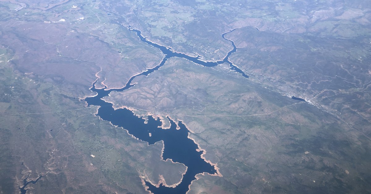
Don Pedro has two dams. One holds back the lake you see today; the other normally lies beneath it. The reservoir supplies water for the canals beside Turlock’s streets and the farms around town. Through a separate treatment system, it also supplements the city’s drinking water.
On this page: The Turlock connection · Two dams and a vanished town · Water, power and flood control · Where to visit
Why a dam near La Grange matters in Turlock
Don Pedro sits on the Tuolumne River in the Sierra foothills near La Grange. It is a drive out of the Valley, rather than a lake at the edge of Turlock. The connection becomes clearer if you follow the water downstream: a large reservoir stores it, a much smaller dam diverts it, and canals carry it toward the farms.
TID’s 2025 Agricultural Water Management Plan, adopted in March 2026 describes the route. Releases from Don Pedro enter the river. At La Grange Dam, part of that flow enters TID’s Upper Main Canal and travels to Turlock Lake. From there, the district’s main canal and laterals distribute irrigation water. Gravity does much of the work; the amount available depends on the water year and operating requirements.
La Grange Dam, built in 1893 raises the river high enough to send water into the canals. It serves a different job from Don Pedro’s seasonal storage. Turlock Lake began as Davis Reservoir in 1913 and was the district’s principal storage before the first Don Pedro opened. Today it helps balance the canal system. Our history of Turlock Irrigation District follows that larger story.
This is why a lake level in the foothills can matter to someone growing almonds near Denair or watching water run beside Canal Drive. In August 2023, the Turlock Journal reported full canals during controlled releases following the wet winter and heavy snowpack. That was a particular water year, not a promise of the same conditions every summer.
The first Don Pedro: a construction camp with its own school
Modesto and Turlock irrigation districts built the original dam together. MID’s institutional history records the ceremonial start on June 25, 1921: directors from the two districts pressed buttons to set off a dynamite blast. Workers and families lived in a temporary settlement with barracks, a mess hall and a hospital. A school opened that November under teacher Sophia C. Tucker, with 22 pupils.
The last concrete was poured in March 1923. Dedication followed on June 25, exactly two years after the start. At 284 feet, the concrete structure was then described as the world’s highest gravity dam. That qualification matters: it was a record for that kind of dam. The school and family housing are a reminder that this was also a short-lived community, with children growing up beside an enormous building project.
The old reservoir held about 289,000 acre-feet—roughly a growing season’s supply, according to TID’s powerhouse history. The districts wanted storage that could carry water from wetter years into drier ones. The original project also brought a second change to Turlock: the district began retail electric service in 1923.
A bigger dam, an underwater predecessor and Jacksonville
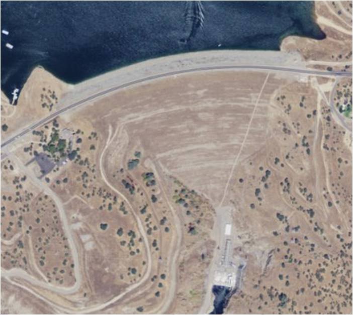
Voters approved bonds for the larger project in 1961. Construction began in 1967 and was completed in 1971. TID’s reservoir description identifies the new dam as an earth-and-rock structure with a clay core, about 580 feet high. Its material included dredge tailings from La Grange: debris left by gold mining became part of a modern water project.
The current reservoir can hold 2.03 million acre-feet, roughly seven times the original capacity. The recreation agency’s history explains the detail that makes the two-dam story unusual: the 1923 structure was left in place, about a mile and a half upstream. The rising lake submerged it. It is still there, rather than having been dismantled to build the replacement.
The larger lake also covered the former site of Jacksonville. Residents left and roads were relocated; this should not be pictured as a complete village of houses sitting intact under the water. MID dates the new dam’s dedication to May 22, 1971. In less than 50 years, the districts had built one major storage project and then overtaken it with another.
Who was “Don Pedro”?
The name reaches back to Pierre Sainsevain, a French immigrant who arrived in California in 1836 and later worked in the mining country. Pierre became Pedro in Spanish usage; the settlement known as Don Pedro Bar supplied the name that passed to the dam and lake. The recreation agency’s history connects that personal name with the Gold Rush landscape.
The foothills’ story began long before mining. The Tuolumne Band of Me-Wuk Indians’ own history describes generations living with the area’s fish, acorns, plants and wildlife, and the damage that mining brought to waterways and gathering places. The tribe remains a living community. Reporting on archaeological work around Don Pedro shows how the project landscape contains layers of Native occupation, mining, roads and settlement—not just a dam construction story.
A reservoir doing several jobs at once
Irrigation is the most visible Turlock connection, but operators also balance electricity, flood regulation and river conditions. TID lists the powerhouse at 203 megawatts of generating capacity, shared with MID. A fourth generating unit was added in 1989. Capacity describes what equipment can produce under suitable conditions; it is not a claim that the plant supplies that amount every hour.
Part of the reservoir is reserved for winter flood regulation. A falling or visibly low lake can therefore reflect planned operations as well as dry weather. The project is jointly owned by TID and MID. San Francisco helped finance the larger project and participates through coordinated water-banking arrangements; the recreation agency says it does not physically divert Don Pedro Reservoir water into its own supply system.
Turlock’s household supply has a more recent river connection. The State Water Board’s 2023 completion announcement describes the regional treatment plant serving Turlock and Ceres, initially capable of treating 15 million gallons per day. It supplements groundwater supplies. TID’s regional water project account explains the riverbed infiltration gallery and the partnership formed by the cities in 2015. Stored river water, a downstream intake and drinking-water treatment are separate steps; the lake is not a direct pipe to a kitchen faucet.
The next operating license is also a current public issue. A January 2026 state environmental-review notice calls for a full environmental impact report for Don Pedro relicensing and La Grange licensing. Water supply, power, fish, recreation and tribal cultural resources all figure in that review. The notice starts a review process; it does not announce an approved new license.
Visiting Don Pedro: choose a lake entrance
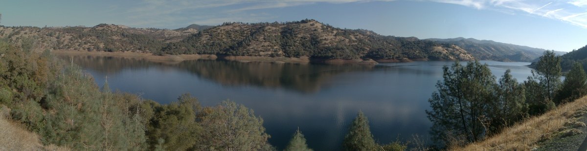
For an outing, use a recreation entrance rather than assuming the dam crest or powerhouse is a public tour stop. The official recreation-area guide describes three distinct bases:
- Fleming Meadows — 11500 Bonds Flat Road, La Grange, CA 95329. A marina, boat ramp, picnic areas and several camping styles, including full-hookup sites. Its sand-bottom swimming lagoon is separate from the open reservoir. Check the lagoon’s season before planning a swimming day.
- Blue Oaks — 10150 Bonds Flat Road, La Grange, CA 95329. Campgrounds, group sites and hiking on the western side. This is a useful place to start when walking and camping matter more than a lagoon.
- Moccasin Point — 11401 Jacksonville Road, Jamestown, CA 95327. Access to the eastern arms of the reservoir, with a marina, camping and picnic facilities. Compare the drive with the west-side entrances before booking.
For walking distances, read the official day-use information carefully. The Blue Oaks shoreline route is approximately 5.9 miles one way; an out-and-back is nearly 12 miles. Moccasin Point’s shorter trail is approximately a mile round trip. Those are quite different outings, especially in foothill heat. Dogs are subject to park rules and are not allowed in the swimming-lagoon area.
The recreation agency’s headquarters and visitor information is at 10201 Bonds Flat Road, La Grange, CA 95329, telephone 209-852-2396. Office hours are not the same as recreation-area access hours. The agency warns of poor cell reception, so save the route and reservation information before driving out.
Before loading the boat or packing the car
- Choose the entrance first. Fleming Meadows, Blue Oaks and Moccasin Point serve different parts of a large reservoir. Put the actual entrance address in Maps.
- Check fees and availability. Use the 2026 fee schedule and official booking system. A marina rental may not include the recreation-area entrance charge.
- Read boating notices before towing. The agency’s golden-mussel notice explains the clean, drain and dry precautions. Check current ramp and access notices as well; an older photograph or camping listing does not establish today’s launch conditions.
Related reading: TID history · farms and farm stands guide · nearby towns and destinations.
